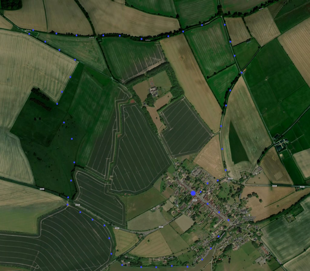
A 4-mile, circular, walk starting from Hindon: quiet country roads, byways, and some field walking. Gentle slopes. Click here for an aerial view. Click here for a downloadable PDF guide of this page. (There is a GPX route option here for phone/tablet download. But only follow this link after watching this GPX help video). Friendly warning: all files relating to walks are published here on good faith but on the understanding that users must be responsible for their own safety and wellbeing.
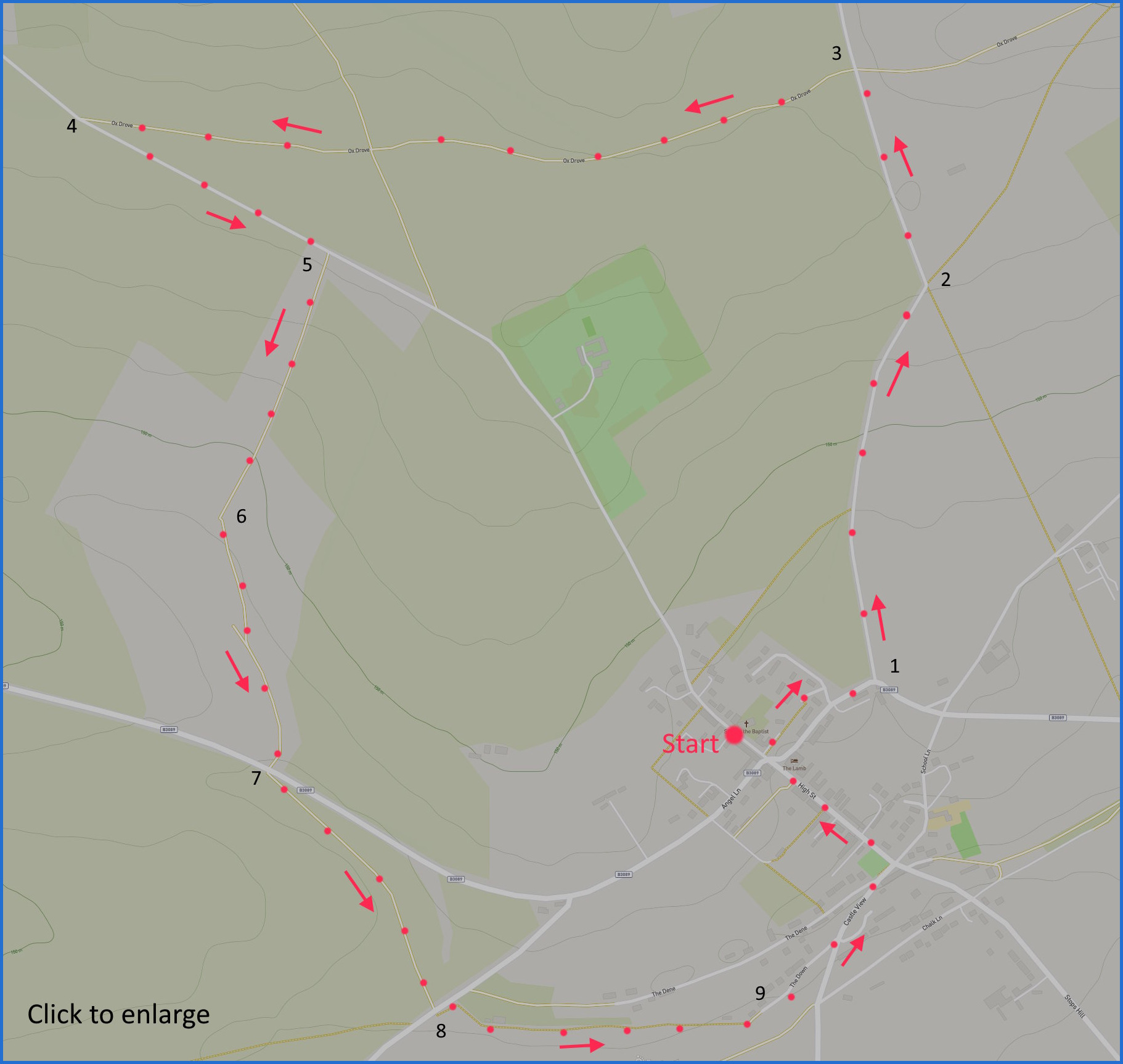
(Routes from map points + metres to next point)
Start: Take footpath beneath village store, follow to (busy) main road and left turn 360m
1: Ascend gentle incline to leftwards bend 720m
2: Continue on lane until restricted byway on left 380m
3: Follow the route until meeting country road 1.4Km
4: Turn left on road and follow until field entrance on right 470m
5: Either take path to left of field edge, or right until gate on left 500m
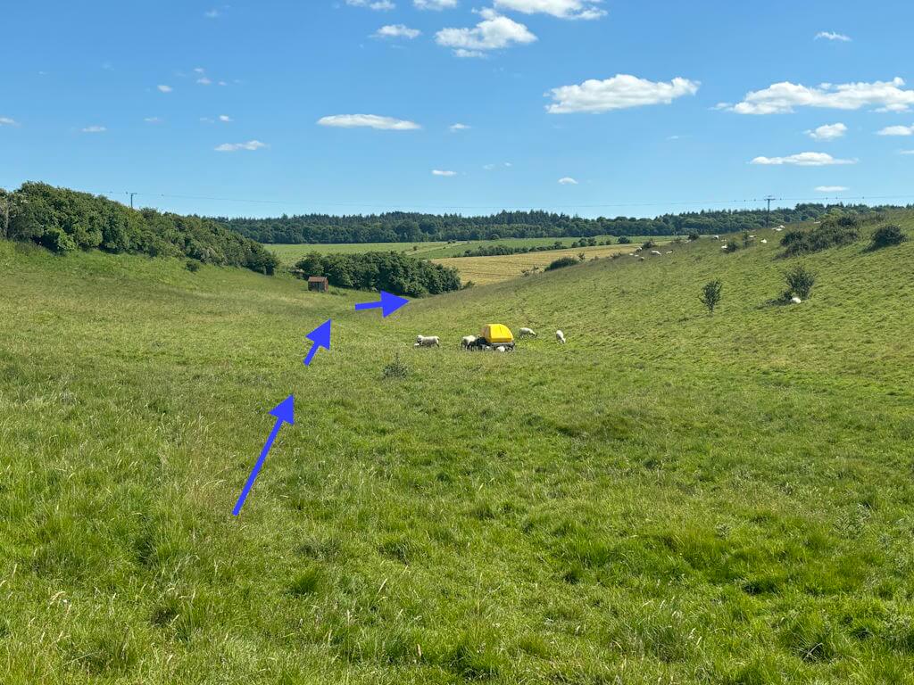
6: At this gate, start to walk diagonally (see pic here) towards road 460m
7: Cross road, immediately opposite: take curving, carved out field path to road 540m
8: Turn left, few metres, path entrance on right, left a little parallel to road the follow narrow path 565m
9: Join lane and some housing, main road, back to start 700m
The pictures below are in the order things were seen on this walk. Clicking on any one will enlarge it (and the slideshow)
![[A]](https://wiltshirewalks.com/wp-content/uploads/2024/06/hindon01.jpg)
![[B]](https://wiltshirewalks.com/wp-content/uploads/2024/06/hindon02.jpg)
![[C]](https://wiltshirewalks.com/wp-content/uploads/2024/06/hindon03.jpg)
![[D]](https://wiltshirewalks.com/wp-content/uploads/2024/06/hindon04.jpg)
![[E]](https://wiltshirewalks.com/wp-content/uploads/2024/06/hindon05.jpg)
![[F]](https://wiltshirewalks.com/wp-content/uploads/2024/06/hindon06.jpg)
![[G]](https://wiltshirewalks.com/wp-content/uploads/2024/06/hindon07.jpg)
![[H]](https://wiltshirewalks.com/wp-content/uploads/2024/06/hindon08.jpg)
The Walk
The suggested start is around the parish church. If you come by car there is some street parking nearby. To avoid the rather busy main road, it is suggested you take the footpath alongside the village shop, which gets you almost to point 1 on the map (be careful on the short section of main road there). After that, it’s a gentle incline on a very quiet road. Then you take the ox drove across country to join another quiet road. The field path between 5 and 7 needs navigating carefully. Depends on access, but if you take the gate and walk right alongside the hedge/fence you need to cross into the adjacent field at the gate 2/3 of the way down. Or enter the first field on the other side if you can and veer left at the gate to take a diagonal route (as shown here). At point 7 there is a carved out curved route to join the road, cross and pick up the path that winds along side the trees.
The town
Not sure if it’s a village or a town but it’s an attractive settlement. The original church was destroyed in 1754 by the great fire of Hindon. This one is a Victorian replacement. After that fire, houses on High Street were rebuilt and are of an agreeable common 18th century style to admire today. The street is also striking for the trees that were planted down its length.
In the mediaeval period Hindon was a prominent market town and prospered from that and from fairs. In the 18th century it was also a major coaching town – meaning that at one point there were 14 Inns in the town – now there are 2 but one of them (the Grosvenor) has stables (converted) at the rear. The current main road was a major Exeter – Barnstable route. But all this was undermined by the appearance of railways that connected Exeter, Taunton and London, with Hindon bypassed for Tisbury nearby.
More can be found about Hindon as a community here. And more about its history here. Both or the two pubs in the town will reward a visit: That is the Grosvenor and The Lamb. i