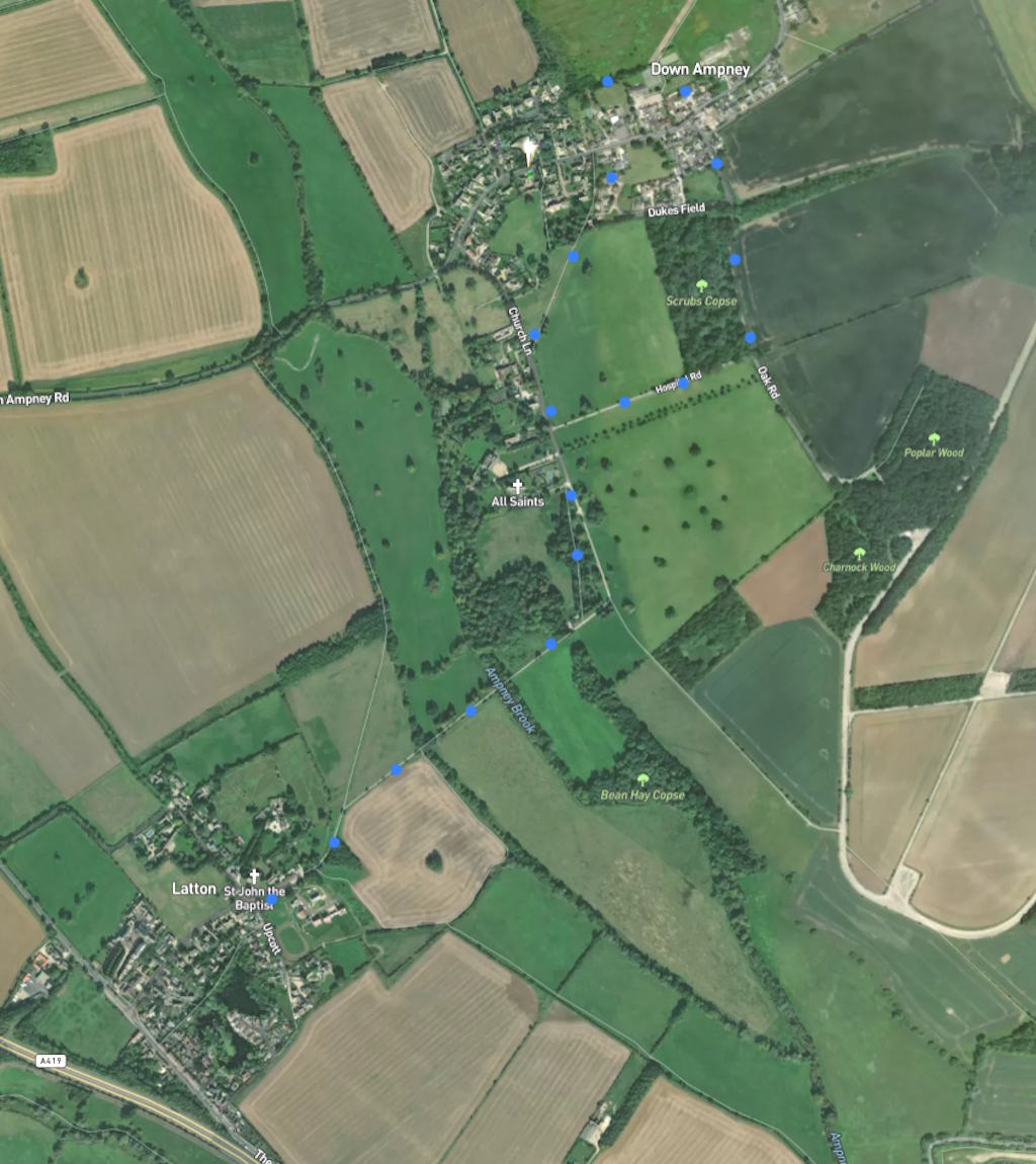
A 3-mile easy walk: quiet roads and marked field paths (2 stiles). It starts near the Latton church. Click map below to enlarge. Click here for an aerial view. Click here for a downloadable PDF guide of this page. (There is a GPX route option here for phone/tablet download. But only follow this link after watching this GPX help video). Friendly warning: all files relating to walks are published here in good faith but on the understanding that users must be responsible for their own safety and wellbeing..

Start: Some parking by church. Walk Gosditch Road, enter fieldpath at gate 270m
1: At Y-junction walk on the rightwards path until path junction on left 560m
2: Take this left path through hedge growth towards church. Walk Church Lane until path on right 525m
3: Take marked fieldpath on right and walk towards Down Ampney main street 450m
4: Turn right, walk towards Y-junction and take right fork 220m
5: Walk forward until Hospital Road path turning on right 480m
6: Take right turn and walk back towards Church Lane 440m
7: Walk on past church until gith turn and fieldpath resumed back to start 1.3km
The pictures below are in the order things were seen on this walk. Clicking on any one will enlarge it (and the slideshow)
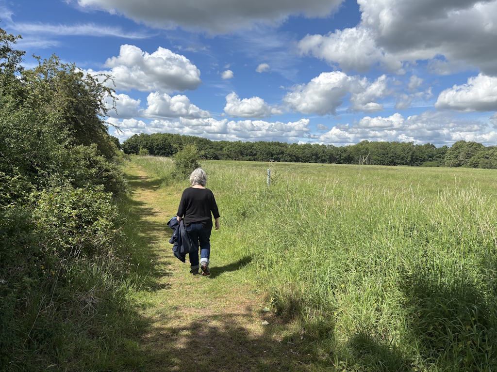

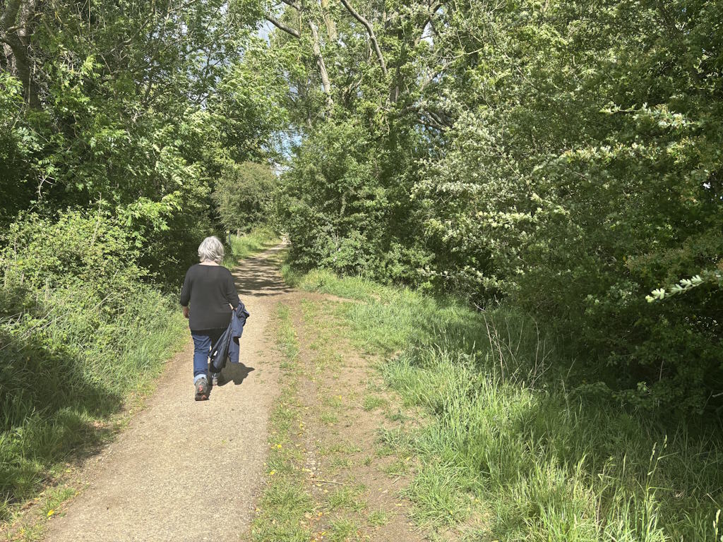

The walk
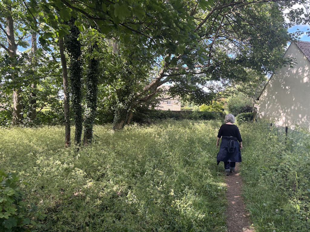
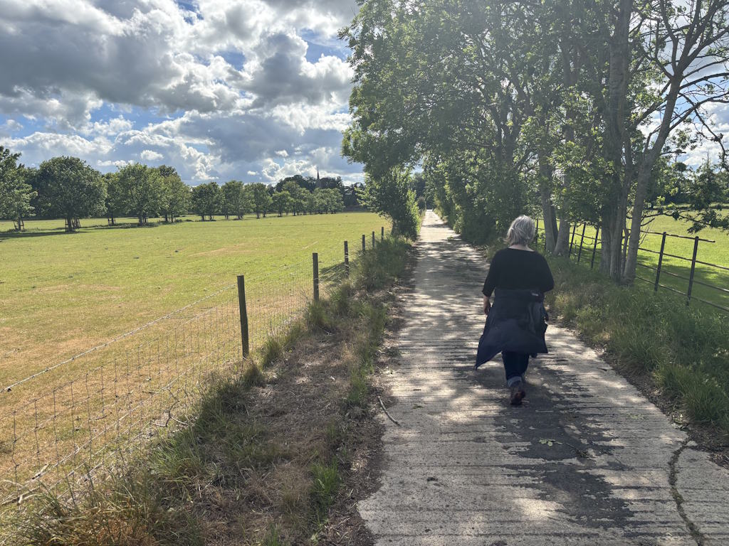
The walk drifts from Wiltshire (Latton) into Cotswolds (Down Ampney). The lanes are quiet (although there is some background traffic hum from the Swindon road). The fieldpaths are well marked and easy to follow (a couple of stiles). The short path from point 2 on the map up to the church is a bit overgrown and there may be some nettles to wade through. (For that reason a parallel route is suggested on the way back, which you could take if you prefer on the way up also.) All in all, an agreeable little walk.
Latton
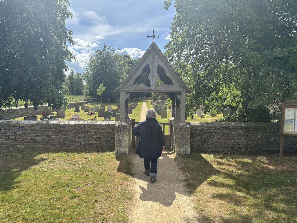
There was a settlement at Latton before 1066. You can get much more detail about its history if you go to this site. The village includes a 12th century church with five bells. It is from here that the walk starts. the church was locked when we visited. But if you are more lucky, you might look out for the font which seems to have been made from a column liberated from a nearby Roman villa. A reminder that the village is on Ermin Street, the Roman Road which ran southeast–northwest from Silchester to the present-day Cirencester and Gloucester (and where the traffic hum originates). Latton was a canal village – interested visitors might enjoy this video explaining how it necessitated the “battle of the Latton bypass”
Gravel extraction began on a small scale here in the 16th century, Extensive sand and gravel was mined from land south-west of Ermin Street in the mid 1990s. Two lakes from these extractions form an extension of the Cotswold Water Park. The Co-op Society had a creamery near Latton from 1935, which employed some 139 people in 1956; it closed around 1996. A timeline of the village history is in this PDF file.
Down Ampney
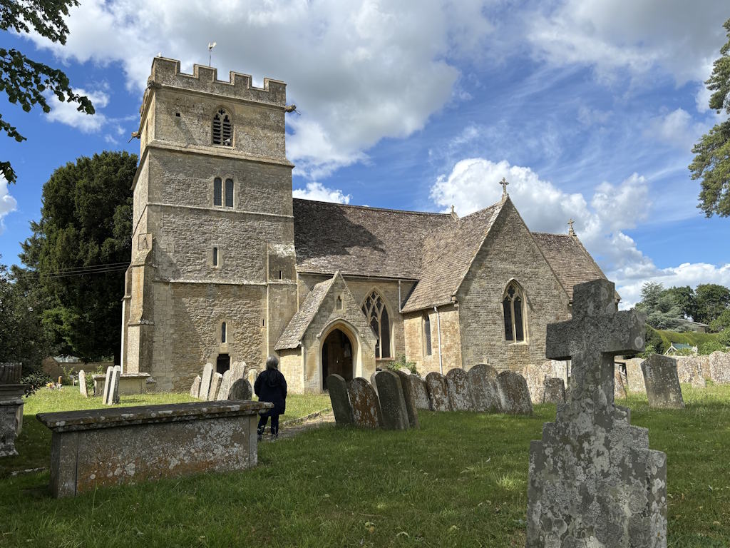
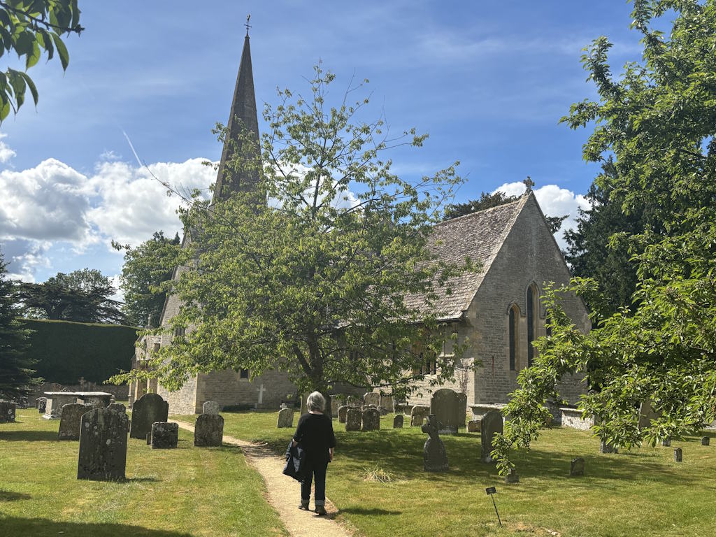
All Saints Early English style Church was built by the Knights Templars in 1265. The spire was added in the late 14th century. The important Wiltshire Hungerford family are acknowledged at various points (NB North transept). But much of the fabric of the church reflects Victorian renovation. It may seem odd that the building is so far from the centre of the village but buildings were relocated after the black death in the 14th century. The church echoes the presence of the RAF during WWII with an exhibition particularly acknowledging the role of the airfield in the Battle of Arnheim and an annual service of commemoration. Notice the poppies stencilled on the arches of the aisle.
The composer Ralph Vaughn Williams was born in the Old Vicarage in 1872. His father was vicar of the church and is buried in its churchyard. Vaughn Williams composed at least two pieces to honour his birthplace: ‘The Lark Ascending’ and ‘Down Ampney, Come down, O Love Divine‘. See memorial stained glass window in the south part of the chancel, Note the 117 handmade kneelers in the church.
On the main street, you can get coffee in the post office and shop – across the street half way along the route recommended on the map. The primary school nearby on that side was built in 1853 and is still flourishing. If you want to learn more about the village, you might browser their village magazine. Or for a video guide to the history of the village, try this site or this site)