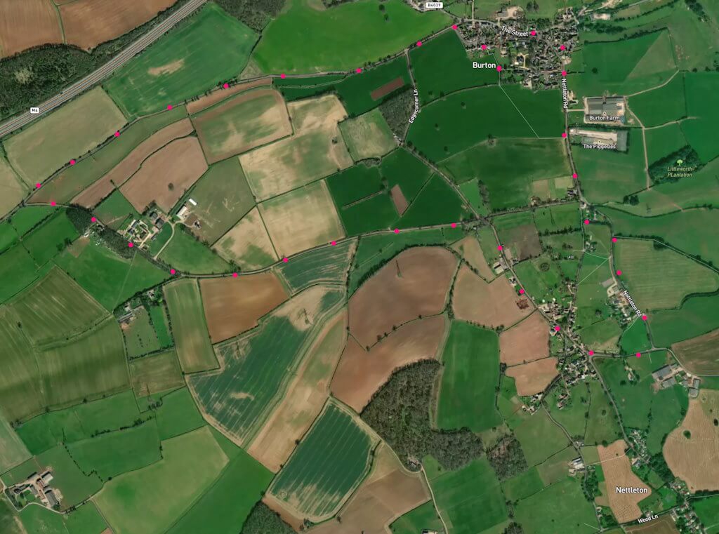
A 4-mile, easy, flat walk on quiet roads with mainly good verges – but, as always, take care in case of occasional vehicle. Click here for an aerial view. Click here for a downloadable PDF guide of this page. (There is a GPX route option here for phone/tablet download. But only follow this link after watching this GPX help video). Friendly warning: all files relating to walks are published here on good faith but on the understanding that users must be responsible for their own safety and wellbeing.
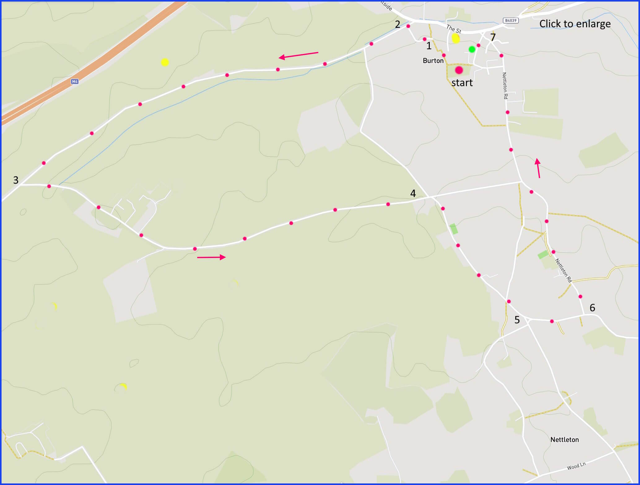
(Routes suggested from each map point + metres to next point)
Start: Opposite tower end of church, take footpath gate across to houses, then to road ‘Toll Down Way’: 160m
1: Follow this residential road to junction: 130m
2: Turn left and follow this road to Y-junction: 1.7Km
3: Take left turn signed to Nettleton/West Kington. Walk to cross roads: 1.7Km
4: Take right turn at Edgecorner Lane X-roads, walk on to diamond crossroads: 620m
5: Follow left road, signed to Burton continuing until a right turn: 250m
6: Take Nettleton Road right turn, walk up slope to main road ‘The street’: 1.3km
Start: Take Church Hill back to church and start: 170m
The pictures below are in the order things were seen on this walk. Clicking on any one will enlarge it (and the slideshow)
![[B]](https://wiltshirewalks.com/wp-content/uploads/2024/01/burton02.jpg)
![[C]](https://wiltshirewalks.com/wp-content/uploads/2024/01/burton03.jpg)
![[D]](https://wiltshirewalks.com/wp-content/uploads/2024/01/burton04.jpg)
![[E]](https://wiltshirewalks.com/wp-content/uploads/2024/01/burton05.jpg)
![[F]](https://wiltshirewalks.com/wp-content/uploads/2024/01/burton06.jpg)
![[G]](https://wiltshirewalks.com/wp-content/uploads/2024/01/burton07-1.jpg)
The Walk
If you arrive by car, parking opportunities are limited. One would be close to the wall on Church Hill (green circle on map). Another might be the (yellow circle) pub car park (although being a customer at some point would be appropriate). This area is the so-called “Cotswolds quarter” of Wiltshire. However, neither villages nor landscape convey the magic normally associated with the word “Cotswold”. Instead the walk is a straight and flat journey over farmed land and between villages that are welcoming – if not visually striking. But that should still be an agreeable couple of hours. At point 5 on the map the walk could be extended to an additional square shape, one that takes in the full area that is Nettleton. Although the route is on country roads, less than 10 vehicles went passed us during this 90-minutes of walking (admittedly a Sunday in January).
The villages
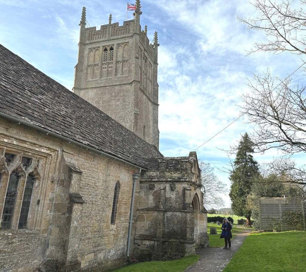
Although the administrative parish is “Nettleton, Burton and West Kington”, Burton is the most substantial of the two settlements covered by this walk. It includes a fine parish church (Grade 1 listed) that dates from the late 13th century – with some remodelling over the following 200 years. The 15th century tower is striking and hangs six bells – one of which is over 500 years old. Nearby you may notice that there is a rectory (1605 but with big changes over time) – now a private house.
Being so close to the Roman Road that is the Fosse Way, it is not surprising that remnants of settlement from that period have been discovered. These finds comprise about 30 buildings and include a temple (c. AD69) apparently dedicated to Apollo. An annotated walk around this area can be found at this link. In more recent (medaeval) times Burton was part of the Wiltshire woolen industry. This was largely thanks to the water power derived from the River Bybrook – which you walk alongside in the first part of this route. An indication of the reach of this river is apparent in this link of former mills,
Burton has a surprisingly busy digital presence. There are two village websites: this one and this one. And there is a particularly active online newsletter called the Burton Bugle. You might also care to explore the local farmshop and the very agreeable village pub called The Old House At Home (not such a rare name – supposedly based on a Victorian song). At least at the time of writing this you will find a good menu there.