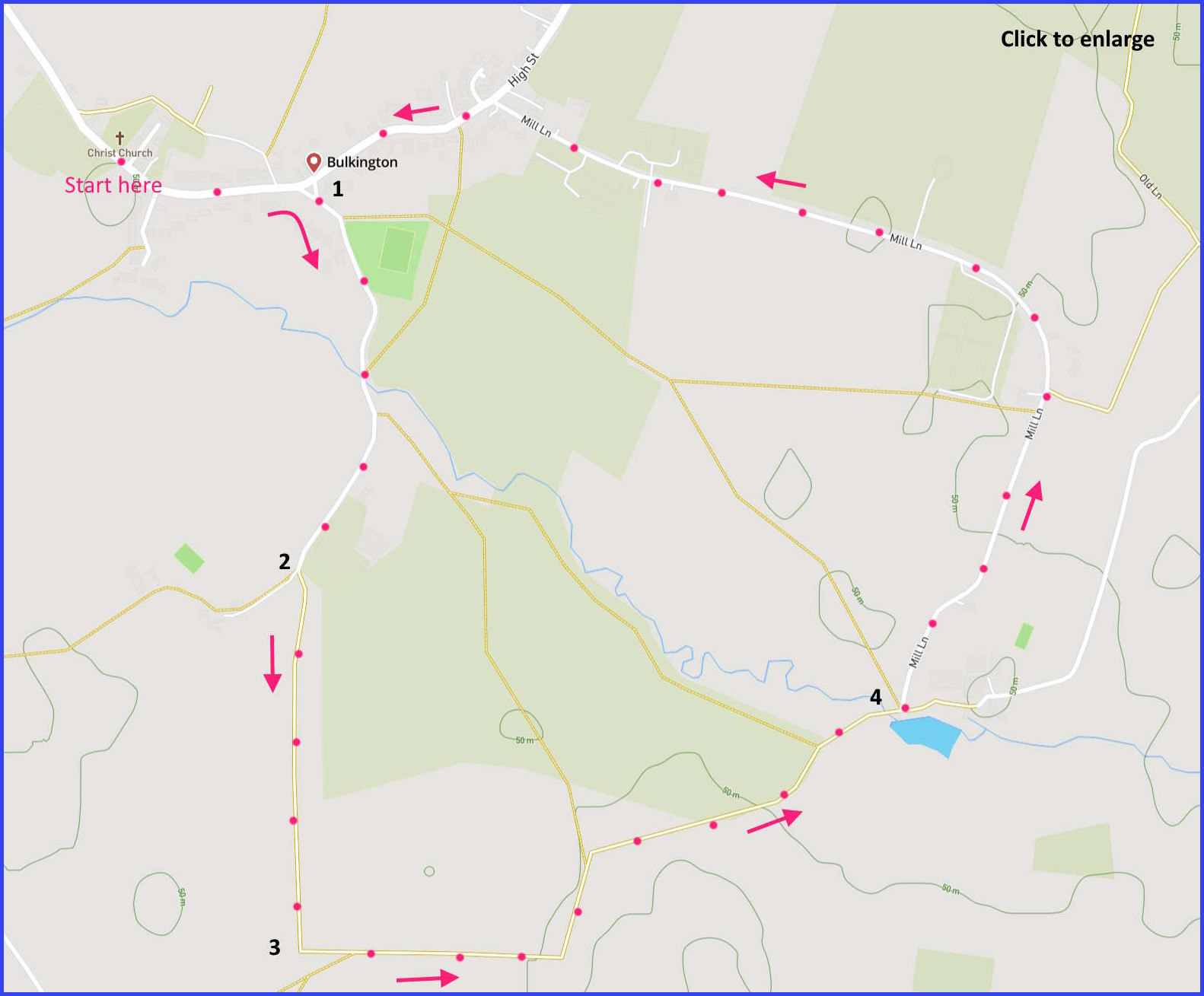
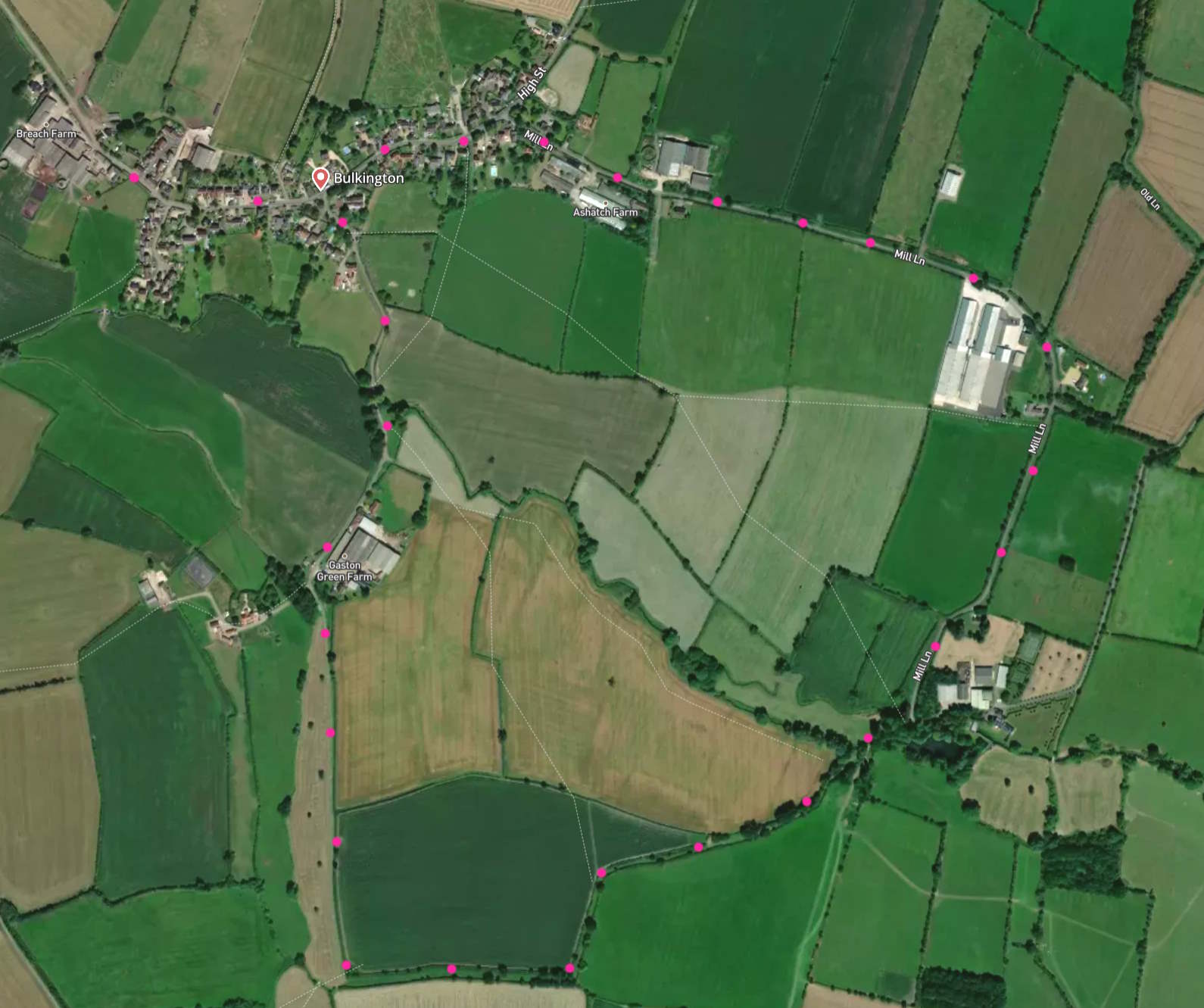
(Routes suggested from each map point + metres to next point)
Start: Walk left away from church towards war memorial junction: 310m
1: Cross road, take lane until Y-junction at farm: 600m
2: Follow bridlepath a left fork until facing hedge and gate to left: 530m
3: Left: Continue on bridlepath until bridge over Semington Brook. Veer left to lane: 1Km
4: Follow Mill Lane towards High Street, turn left and return to start: 2Km
The pictures below are in the order things were seen on this walk. Clicking on any one will enlarge it (and the slideshow)
![[A]](https://wiltshirewalks.com/wp-content/uploads/2023/05/buckington01.jpg)
![[B]](https://wiltshirewalks.com/wp-content/uploads/2023/05/buckington02.jpg)
![[C]](https://wiltshirewalks.com/wp-content/uploads/2023/05/buckington03.jpg)
![[D]](https://wiltshirewalks.com/wp-content/uploads/2023/05/buckington04.jpg)
![[E]](https://wiltshirewalks.com/wp-content/uploads/2023/05/buckington05.jpg)
![[F]](https://wiltshirewalks.com/wp-content/uploads/2023/05/buckington06.jpg)
![[G]](https://wiltshirewalks.com/wp-content/uploads/2023/05/buckington07.jpg)
![[H]](https://wiltshirewalks.com/wp-content/uploads/2023/05/buckington08.jpg)
Buikington village
Although there is evidence of a settlement here from the 12th century, the present village projects a largely 20th century ambience. Even the church is only from 1860 (there was an earlier one but it burnt down). Nevertheless, Christ Church is readily visited as a starting point for the walk. At its historical peak, Bulkington was a traditional Wiltshire wool village – with a fulling mill on Mill lane. One doctoral thesis has taken the village as a detailed case study. The case being made was that – contrary to standard opinion – West Wiltshire did not see a decline in the trade during the Tudor period. Because it seems it prospered here (and elsewhere). Although prosperity did not last long after that period.
At the present time the community seems close and busy – as apparent from its useful and well maintained website. Central to the village there is a stepped war memorial (a turning point on this walk), and then The Well: a decent pub that might make a good concluding point to this walk.
The walk
This is a simple walk starting in a small Wiltshire village and passing through quiet farmland. Parking is possible on Chestnut drive (just beyond church). The walk is a circle bisected by Semington Brook. The route is a roughly equal mixture of lanes and fieldpaths/bridleways.
Thankfully, the lanes are very light on traffic, with the final section of Mill Lane being basically a cul-de-sac. There is an unexpected quantity of single storey housing on Mill Lane – perhaps a spontaneous community of more elderly residents? While the main housing stock of the village is around the High Street: in an organisation that my Geography teacher used to call “ribbon development”. In this case the ribbon hosts an unusual variety of modern detached housing styles: reflections upon which might supply some visual entertainment before The Well (or, if not, then the car).