A pleasant 4-mile walk on quiet lanes – with short fieldpath section towards end. No stiles, cattle, obstacles. Click map to enlarge. Click here for an aerial view. Click here for PDF download of these pages. There is a YouTube walk outline here. (There is a GPX route option here for phone/tablet download. But only follow this link after watching this GPX help video). Friendly warning: all files relating to walks are published here in good faith but on the understanding that users must be responsible for their own safety and wellbeing.
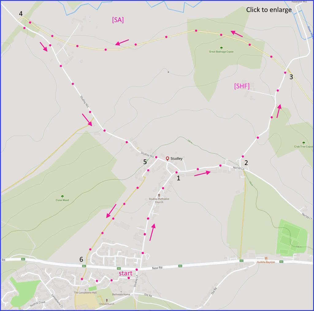
(Routes suggested from each map point + metres to next point)
Start: If parked in Chapel Street, join Studley Lane, cross A4, continue up lane opposite: 670m
1: Veer right to continue, now on Norley Lane: 300m
2: Follow sign left to Norley Lane until stone bridge: 550m
3: Take down path on far side of bridge until joins path going under bridge. Turn right and follow until path meets paved lane: 1.4Km
4: Left on lane. Follow until (paved) right turn near ‘footpath’ sign: 1Km
5: Paved path leads to field path to left of facing houses. Field to main road: 600m
6: If parked, cross A4 and re-locate vehicle on Chapel Street: 200m
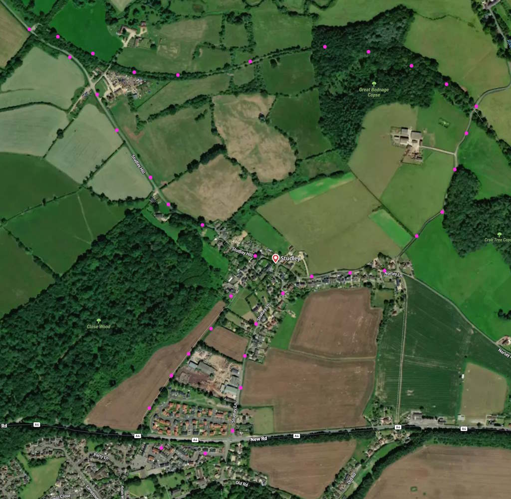
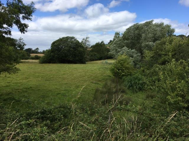
The pictures below are in the order things were seen on this walk. Clicking on any one will enlarge it (and the slideshow)
![[A]](https://wiltshirewalks.com/wp-content/uploads/2023/06/studley_01.jpg)
![[B]](https://wiltshirewalks.com/wp-content/uploads/2023/06/studley_02.jpg)
![[C]](https://wiltshirewalks.com/wp-content/uploads/2023/06/studley_03.jpg)
![[D]](https://wiltshirewalks.com/wp-content/uploads/2023/06/studley_04.jpg)
![[E]](https://wiltshirewalks.com/wp-content/uploads/2023/06/studley_05.jpg)
![[G]](https://wiltshirewalks.com/wp-content/uploads/2023/06/studley_07.jpg)
![[H]](https://wiltshirewalks.com/wp-content/uploads/2023/06/studley_08.jpg)
The walk
The lie of this route might strike you as ‘nature undisturbed’. And pleasantly so. The human settlement part comprises just sparsely populated lanes. While the pastoral part comprises seemingly well manicured fields and hedgerows. There is barely any traffic. Yet today’s Studley hides a much more energetic history. What is barely evident in the small area of this Studley walkscape is a past comprising major Roman roads, a Victorian railway, a working canal, an aqueduct, a manor house, numerous farms, and a prosperous monastic community. Our walking route runs through, or alongside, this history – the key features of which have somehow dissolved to become barely visible today.
Yet striving to detect the signs of this past should be an attractive challenge. So the notes below offer some suggestions on what to look out for and some hints at route points where your imagination might get active.
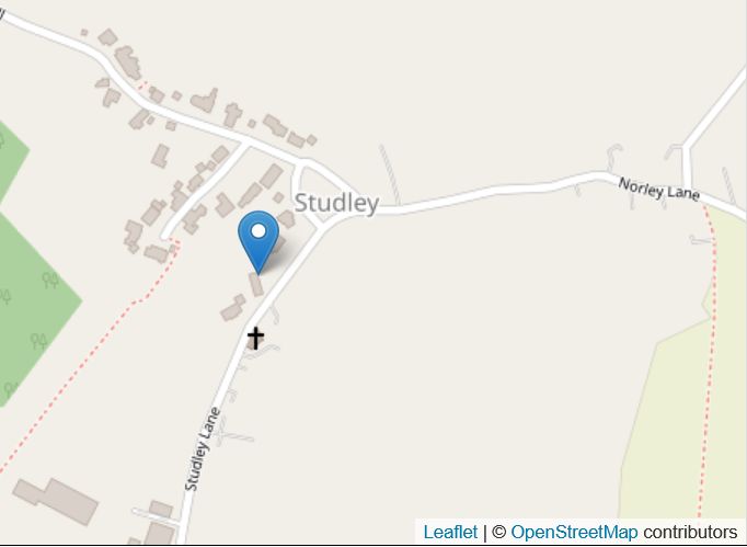
Studley village
We start on Studley Lane, and then there is Norley Lane. Studley is a place, but Norley isn’t. Norley was once a farm, and the farm simply gave its name to a lane. Studley, on the other hand, is an actual place: it sits at the intersection of these two lanes. Certainly it was there in the 12th century. Finally it evolved towards just a Methodist chapel and a few cottages, then growing a little through a drift westward (that is a settlement you meet towards the end of the present route).
These lanes are unassuming now, but they were once part of the early road network that linked London to Bristol and Bath. A route that is still prominent locally in the form of the A4 trunk road crossing Studley Lane (and separating Studley from Derry Hill). East-west traffic on the Romano-British period would have impinged quite deeply into the area that is now the present village.
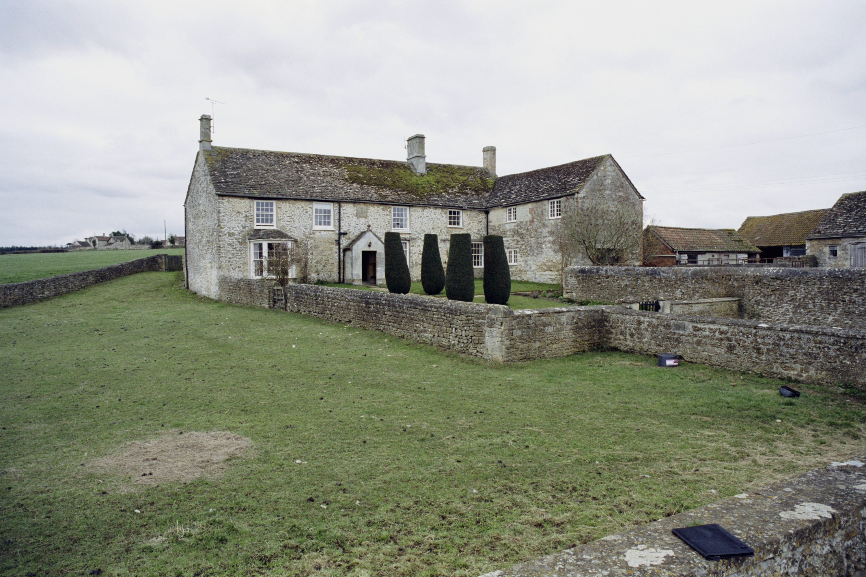
There was a ‘Studley Manor’ here in 1240 but it no longer exists. However Studley House, north of Norley Lane, is probably on the site of that old Manor house. It was notable as a home for the powerful Hungerford family in the 18th century. Sadly, it seems that It burned down and was replaced at the end of the 18th century by what is now Studley House Farm (labelled [SHF] on the route map).
Stanley Abbey
The epicentre of Studley life in the medieval period would have been Stanley Abbey. There is no sign of it now, but it was located at a position marked [SA] on the route map above. It comprised a large area on the south bank of the River Marden (an Avon tributary that runs into Chippenham). The river was doubtless important to the life of the abbey – and later for supporting the development of a wool trade.
This Cistercian community here was founded in 1151 by Matilda (daughter of Henry I) and flourished until the dissolution in 1536. A short account of its history is here and another one is here. But this much fuller source will indicate the considerable scale of the Abbey’s presence. The building extended north to the river and and almost to the path you walk on. Several fulling mills supported the significant sheep farming and its associated wool production in the surrounding area. The abbey was a large and influential settlement: one that enjoyed the extensive patronage of several medieval English monarchs.
It was reduced in size by a fire in 1212 but finally undone by the subsequent dissolution of monasteries – at which time the site was extensively plundered (there is a useful video lecture on its fate here). The only remnant of this period is Abbey Farm, still located near the monastery site. The Abbot’s house survived as a Tudor mansion but, lacking much of a desirable ‘fine view’, it fell into a decline and is only memorialised today by Old Abbey Farm – still visible.
Railway and canal
At point 5 on the route map (termed ‘Studley Bridge’) you shift from field path to paved road. This junction marks part of the route for the old Wilts and Berks canal. There are still signs of this waterway and its towpath if you look closely. A short distance behind you at this point there once stood the Stanley Aqueduct – spanning the Marden. However, today it is visible only as a few stone ruins, because in 1901 it simply collapsed. 13 years later the canal was officially abandoned as it increasingly became a home for rats. (A local talk covering the fuller story of the canal in this area is here).
The Berks and Wilts was important for local goods transport including that for a flourishing bacon trade based at Calne. But even at the time that the canal closed it was already proving inadequate to needs. Accordingly, a branch railway line was created linking Calne to Chippenham. This included the stop ‘Stanley Bridge Halt’, which once stood just a short distance north west from Studley Bridge (point 5 on the route map). Lord Lansdowne (he of nearby Bowood House) insisted that another stop be constructed just for him and his estate (‘Black Dog Halt’).
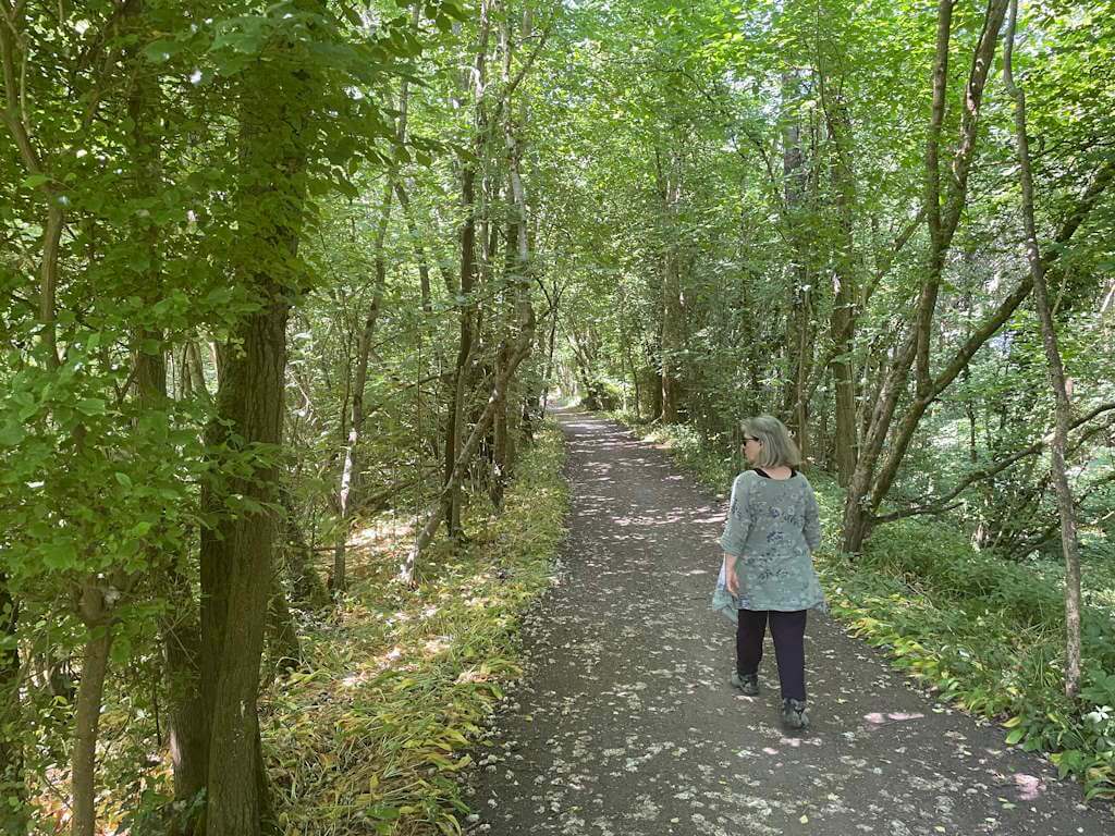
Thankfully, the route of this one-track railway has been partly preserved so that it now forms one section of the National Cycle Network. This is the agreeable path that you walk between points 3 and 4 on our present route.
Afterthought
In sum, within the space of this walk there is much that has imploded over time. A thriving community of monks has ‘dissolved’, an important Manor House crumbled, a working canal has drained itself into nearby Chippenham, and a railway line conceded itself to the cyclist. But, thankfully, the outcome of historical decline defines a fine walk today.