4-mile walk around Cherhill: historic monument, iron age hill fort, Wiltshire white horse and quiet village. What more could one ask for. Ascent is gentle but descent a little steeper: path is marked but care needed. (Click map to enlarge. Click here for an aerial view). Click here for PDF single page download. (There is a GPX route option here for phone/tablet download. But only follow this link after watching this GPX help video). Friendly warning: all files relating to walks are published here in good faith but on the understanding that users must be responsible for their own safety and wellbeing.
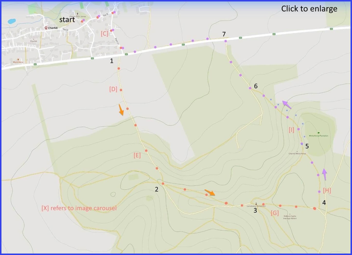
(Routes suggested from each map point + metres to next point)
Start: There is parking outside the parish church. Then walk ‘The Street’ turning right on Park Lane and cross A4. 350m
1: Start gentle chalk path climb up. 700m
2: Through gate, taking the lower path towards monument. 470m
3: Take rough path veering slight left (continuous with that taken from ‘2’ – see picture [G]). 340m
4: Sharp left just before chalk lane junction [H] towards plantation. 460m
5: Admire horse. The path down is steep. Or follow small blue dots hugging plantation for more gentle descent. 300m
6: Through gate and lane to road. 280m
7: Cross and take footpath back to village. 890m
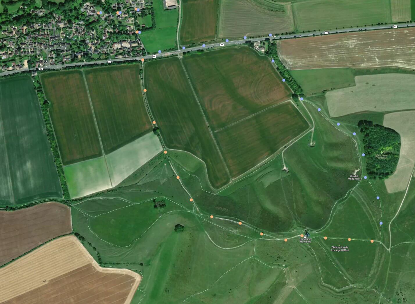
The pictures below are in the order things were seen on this walk. Clicking on any one will enlarge it (and the slideshow)
![[A]](https://wiltshirewalks.com/wp-content/uploads/2022/08/cherhill_01.jpg)
![[B]](https://wiltshirewalks.com/wp-content/uploads/2022/08/cherhill_02.jpg)
![[C]](https://wiltshirewalks.com/wp-content/uploads/2022/08/cherhill_03.jpg)
![[D]](https://wiltshirewalks.com/wp-content/uploads/2022/08/cherhill_04.jpg)
![[E]](https://wiltshirewalks.com/wp-content/uploads/2022/08/cherhill_05.jpg)
![[F]](https://wiltshirewalks.com/wp-content/uploads/2022/08/cherhill_06.jpg)
![[G]](https://wiltshirewalks.com/wp-content/uploads/2022/08/cherhill_07.jpg)
![[H]](https://wiltshirewalks.com/wp-content/uploads/2022/08/cherhill_08.jpg)
![[I]](https://wiltshirewalks.com/wp-content/uploads/2022/08/cherhill_09.jpg)
No stiles – but plenty of ‘steep’. Lots of good things from this walk: Cherhill village, bold Victorian monument, iron age fort, white horse and panoramic views of Wiltshire countryside. A site that has always been a magnet for drone-ers and their cameras to work on. For example, this video – which could give you a foretaste.
Village
Quiet. No shops. But there is a fine church and – adjacent – a 14th century manor house. Although only a cross wing of the original house survives. Excavations suggest that a Roman dwelling once existed beneath it (see here an elegant mosaic relic). A stream (‘River’s Brook’) rises above the village and flows to the west. A couple of mills were worked there once. In 1377 there were 98 folk in the village (well, poll-tax payers anyway). It never grew much beyond that until the 1950s, at which time it had temporarily absorbed personnel from two RAF stations nearby. The main street may once have been part of the London-Bristol road but that now exists south of the village (as the A4, which for this walk you must cross – but carefully).
Accounts of the village often go on about the C18 ‘Cherhill Gang’ – notorious highwaymen. Part of their notoriety arose from their practice of doing hold-ups in the nude. This was supposed to be a bit more terrifying for travellers and – a bonus – made it difficult for the law to identify them later when in normal garb. However, like a lot of local history, there may have been some colouring-in of this story. Some sources say naked robbery was pursued by just one of their number, while others say that, after undressing, they painted themselves all over (perhaps heightening the disguise, or perhaps an erotic extra). Anyway.. naked or not, they tended to end up on the gallows at Devizes. Later getting gibbeted on the nearby Cherhill downs – placed clearly in view to discourage others (although the “others” tended to saw the bodies down and give them a sympathetic burial).
To the monument
This dramatic 120ft needle is at the highest point of, and on the edge of, the Bowood Estate. In 1845 Sir Charles Barry (he who was architect of the Houses of Parliament) was commissioned to design it for Henry Petty-Fitzmaurice, 3rd Marquess of Lansdowne (a landed but worthy politician, strongly supporting the abolition of slavery and repeal of the Corn Laws). Yet the reasons for this exotic structure were not fully understood until the 1920s. Papers unearthed then indicate that it was to commemorate the Marquess’ ancestor, Sir William Petty (d.1687). A man deserving of commemoration, given his distinguished career as scientist, physician, surveyor, economist, Prime Minister, and co-founder of the Royal Society.
Sadly, the monument is now a bit of a mess (see that in closeups here) – with damaged stonework and ugly, if protective, boards around its base. The National Trust say they need £2.7m for repairs. You might think the protective dressing could be hiding an explanatory inscription: but it’s not. However, an intended inscription was recently found in Estate papers. If finallly installed, it would tell visitors of William Petty’s “exalted understanding and indefatigable industry” and reminded us that the country “was indebted for the foundation of science which he laid”. Rather beyond the level of distinction enjoyed by more recent Prime Ministers.
Hill Fort
This well protected iron age hillfort (possibly constructed in the Bronze Age) is known as Oldbury Castle. It’s easily overlooked by visitors drawn to the monument and the horse. But taking a walk across this ground offers a pleasing sense of being on top of the county. Meanwhile, underneath you excavations have revealed domestic artefacts and flints that must imply it was once occupied by a community – also enjoying being on top of Wiltshire. Roman coins were found here, so perhaps at that time? It’s hard to construct the shape of this fort as a casual walker: but this image may help fix it.
The horse
This is the second oldest (1784) of Wiltshire’s white horses (go here for all your white horse information needs). Cherhill’s horse is also more authentic than some – in the sense that it remains a chalk horse rather than one ‘chalked up’ with concrete. Its original cut was supervised by a local apothecary, Christopher Alsop. He is often described as eccentric – because he barked his orders to the workers while positioned a mile away with a megaphone (but let’s be fair, the hill-marking workers cannot judge what their positioning will look like at ground level…and so they need guidance from that distance). Some speculate that its design was influenced by Stubbs’ paintings of horses (he was a visitor at the Estate). There is an equine resemblance. The Cherhill horse once had glass eye, made from upturned bottles pressed into the earth thereby capturing and reflecting the sun. A pity it was not retained – although doubtless there would be a health-and-safety issue.
Maintaining these horses is a chore. This one was refreshed in 2002 when volunteers gave 1000 man-hours to shift 160 tonnes of fresh chalk up the hill. At that time, their renewal was predicted to last 20 years. Fortunately, the Cherhill White Horse Restoration Group exists to groom it periodically. But 20 years?…. Could soon be a significant job on the horizon for those volunteers?
Descent
Before setting off, notice the wheat field way below the monument (you meet it closer on the way down). It has been a much-discussed site for crop circles (remember them?). You can view one of its iconic visitations here. Or go here to share the excitement of enthusiasts more fully. The route down may challenge your quadriceps (not to mention gluteus maximus, peroneus and tibialis anterior). Just don’t think knees – think instead of the metabolic benefits from improving lipid metabolism and insulin resistance. Then, if you do get to the bottom in good form, you might well drop into Cherhill’s agreeable Blackhorse Inn (one of whose rewards is a prominent painting of the Cherhill Gang).