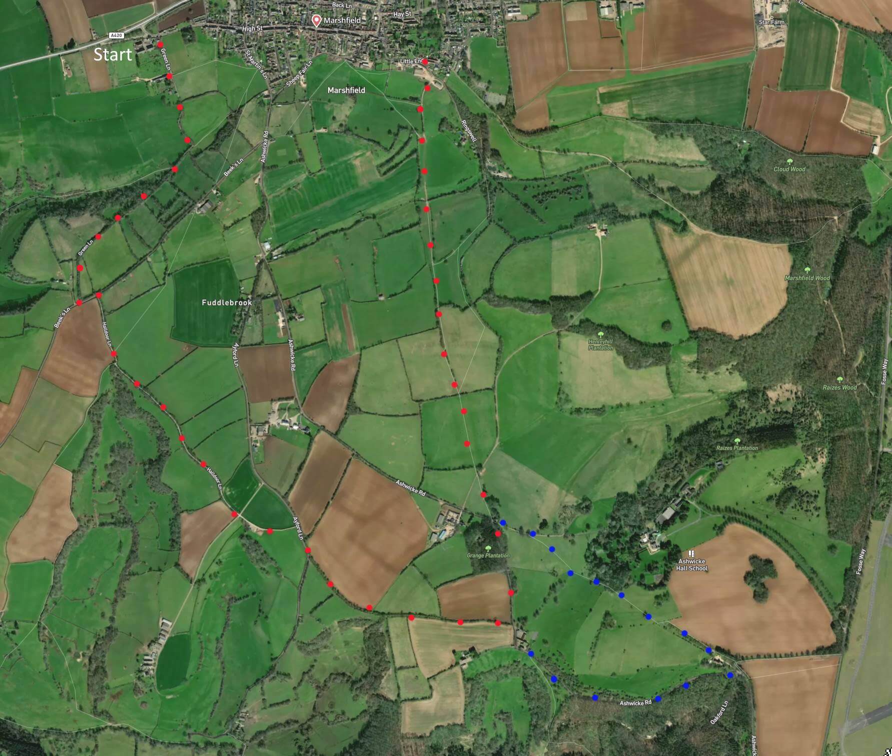
Click map to enlarge. Click here for an aerial view. A 5-mile oval route. Attractive lanes and footpaths. Relatively flat. Scarce traffic, people, or dwellings. Much silence. Many well-shaded paths. Blue dots show optional extension (few old stiles there). Looks complicated but the route will flow into place. (There is a GPX route option here for phone/tablet download. But only follow this link after watching this GPX help video). Friendly warning: all files relating to walks are published here in good faith but on the understanding that users must be responsible for their own safety and wellbeing.
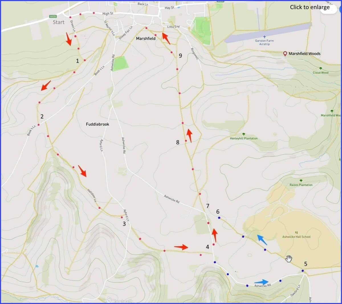
On entering western end of the village from A420, there is marked parking area.
(Routes from map points + metres to next point)
Start: A few yards into village, take Green Lane [A] on right and follow lane, turning into a wooded footpath until reaching a path junction. 780m
1: Turn right and follow Lane on to junction with Beek’s Lane. 800m
2: Head left up slope. In 80m turn sharp right onto marked path. Follow straight route [C] until junction with Ayford Lane. 1.3km
3: Walk about 80m to pick up footpath on left: follow edge of field until reaching junction with Ashwicke Road. 1km
4a: Here you choose: Turn left for shorter route (to point 7). 420m
4b: Turn right for longer. Follow road [I] until you reac a ‘bear left’ sign. 1km
5: Take narrow footpath on left (has a Z-turn after 80m). Pass a fancy house with swimming pool beyond left side fencing. The field path is straight until a telephone poll, take left path here. After 80m, right into open field and walk diagonally across it to wooded entrance. Walk through to a stile onto next field. Again diagonally, until a ragged stile built into lane fence allows you onto lane. 1km
6: Head left towards grand gates at Lodge. 130m
7: On right of lane ahead is gate into field. Enter. Walk along field edge until small gap in hedgerow. 700m
8: Gap invites right shift into adjacent field – but continue walking upwards until field path turns into a more stoney used path. 900m
9: Keep eye on the church tower [J]. Then walk back along High Street to start. 1.4km
The pictures below are in the order things were seen on this walk. Clicking on any one will enlarge it (and the slideshow)
![[A]](https://wiltshirewalks.com/wp-content/uploads/2022/08/marshfield_A.jpg)
![[B]](https://wiltshirewalks.com/wp-content/uploads/2022/08/marshfield_B.jpg)
![[C]](https://wiltshirewalks.com/wp-content/uploads/2022/08/marshfield_C.jpg)
![[E]](https://wiltshirewalks.com/wp-content/uploads/2022/08/marshfield_E.jpg)
![[F]](https://wiltshirewalks.com/wp-content/uploads/2022/08/marshfield_F.jpg)
![[G]](https://wiltshirewalks.com/wp-content/uploads/2022/08/marshfield_G.jpg)
![[H]](https://wiltshirewalks.com/wp-content/uploads/2022/08/marshfield_H.jpg)
![[I]](https://wiltshirewalks.com/wp-content/uploads/2022/08/marshfield_i.jpg)
![[J]](https://wiltshirewalks.com/wp-content/uploads/2022/08/marshfield_J.jpg)
A well-preserved Georgian village (town?) set above wooded valleys. Start near the old toll house on Green Lane (good parking nearby). The first third of the walk offers broad paths shaded by high hedgerows. Also well suited to dog walkers – sometimes there are uniformed ones (perhaps serving the Marshfield aristocracy). The route is fairly flat, although the map suggests easy ways to shorten or lengthen it. But save some time for taking in the village.
The walk
OK: it’s not a Wiltshire Walk. But Pevsner says Marshfield is: “an unspoilt town, in appearance as much North Wiltshire as Gloucestershire”. The walk ends up at the eastern end of the town and your memory of the occasion may be dominated by what you see on your subsequent wander down High Street. The off-town walking route suggested here is more pastures than places. Outside of Marshfield itself, you meet just one significant dwelling place – Ashwicke Hall – and even that is well hidden around the turning point of this circular route. If it were visible, what you would see would be an 1857 Tudor Gothic ‘castle’. A certain Major Maurice Pope lived there until 1946. Then it became variously an approved school and a girl’s convent. In 1982 the buildings were transferred to the International School of Choueifat – part of the shadowy ‘SABIS educational system” (not keen on ‘modern’ methods).
The village
How could this small place have once been the fourth most prosperous town in its county (after Bristol, Gloucester, and Cirencester)? Originally, perhaps, through being a successful wool town. But real wealth came later – it came from 18th century malting. This topic is thoroughly explored in a Channel 4 History Hunters episode – in which the excitable Tony Robinson explains how and where malting was done at Marshfield (although to really get to grips with the process itself, visit a traditional working Wiltshire Malt House in Warminster).
Prosperity from malting left behind a fine selection of Georgian period housing – currently attractive to modern tastes in country living/commuting. The village still retains its shape – an oval bisected by a (quarter mile) High Street. On that street there are 17th century houses with narrow fronts but long plot gardens extending behind. Two rear access lanes (Back Lane and Weir Lane) suggest the oval. The village centre was originally at the east end centred on its parish church, manor houses, and market place (now built over).
High Street
The walk through countryside lands you back at Marshfield’s parish church [H]. A 15th century building with a tall three-stage tower, including a good set of bells (does this video tell enough?). Adjacent at the old village centre are – confusingly – two manor houses. Both rather concealed. There is ‘The Manor’ (priced £2.275m recently) and then the ‘Old Manor House’ (a snip at only £1.577m). From pictures, they both look elegantly manorial – although the former has wound up local planners with unwelcome building ambitions.
The old (once central) market place area around the church is where the Marshfield mummers meet every boxing day. Mummers? It’s a medieval tradition of roaming Christmas players: something resurrected by Marshfield in the 1930s – this video should give you the general idea.
Most buildings on the High Street are of a single period yet they have a wide range of interesting features. For example, shell-pattern door arches of the Queen Anne type. Find one, for instance, at the Catherine Wheel (pub). Which Pevssner suggests is “the most charming building on the street” (it also can offer charming refreshment – and a pleasant outdoor area to enjoy it). Towards the end of the street and on the righthand side are the Alms Houses (1612). There is a book giving a detailed account of their history and daily life therein – the text is strangely rendered here as video. These dwellings were built by the Crispe family for eight elderly villagers, with funds for residence, garden and £11 yearly. Unfortunately, the wherewithal for this generosity came from Sir Nicholas Crispe’s extensive slave trade earnings.
Malting House
Small towns will sometimes claim a brush with celebrity inhabitants. An example for Marshfield is the poet Dylan Thomas. During the Battle of Britain (1940) he stayed on High Street in the C19 Malting House with another writer, John Davenport. About whom Thomas says in correspondence: “He’s an amateur writer & musician, extremely able, weighing nineteen stone. There are lots of other people staying here too: Lennox Berkeley, Arnold Cooke … who are both professional composers, Antonia White, and William Glock. Aren’t they nice names? Davenport & I are writing a fantastic thriller together, so I haven’t done a poem for a long time although there are two I want to write badly: both nightmares, I’m afraid.” But why Marshfield? One attraction was “The Wheel” pub opposite – where much collaborative writing was lubricated.
Thomas had just had a success with Portrait of the Artist as a Young Dog (1940) and he reckoned publishers could be persuaded to take another. It turned out as The Kings Canary – a satire on London literary life (“Canary” refers to the poet laureate). Although it was not published until 1976 – libel anxiety apparently. Today the Malting House is very much the kind of property that excites local newspapers.
In sum, all the necessary ingredients for an agreeable “Wiltshire Walk” – even if it is through South Gloucestershire.