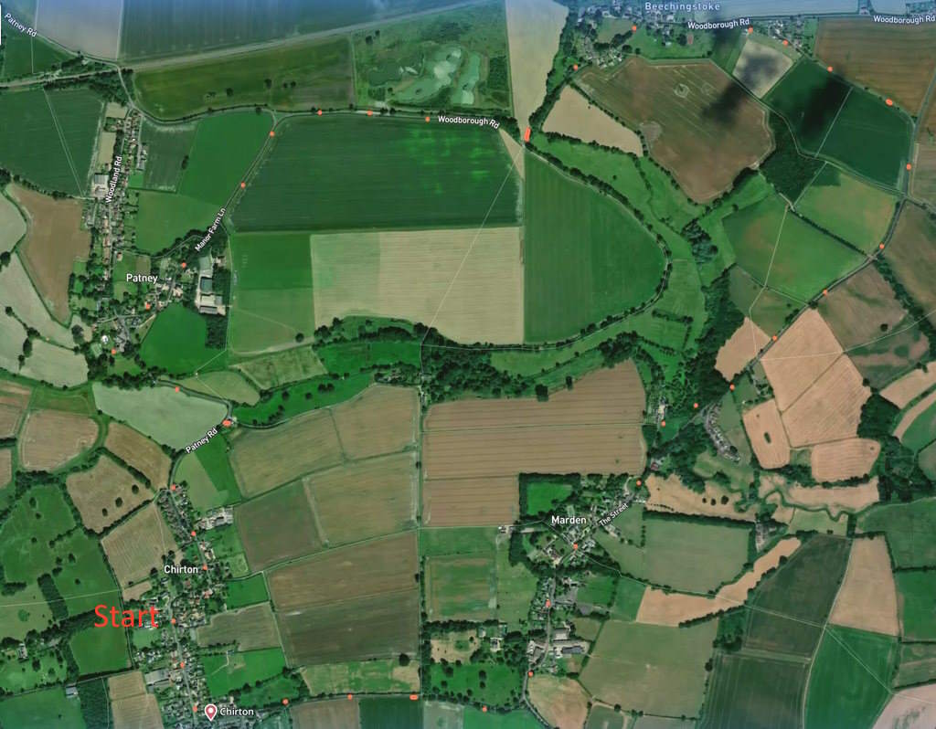
A 4.5 mile flat, no-fields, easy walk. Four Wiltshire villages, four churches, three lakes, two white horses, one neolithic henge, and Pewsey Vale views. Click here for an ariel view. Click here for printable PDF download of this page. (There is a GPX route option here for phone/tablet download. But only follow this link after watching this GPX help video). Friendly warning: all files relating to walks are published here in good faith but on the understanding that users must be responsible for their own safety and wellbeing.
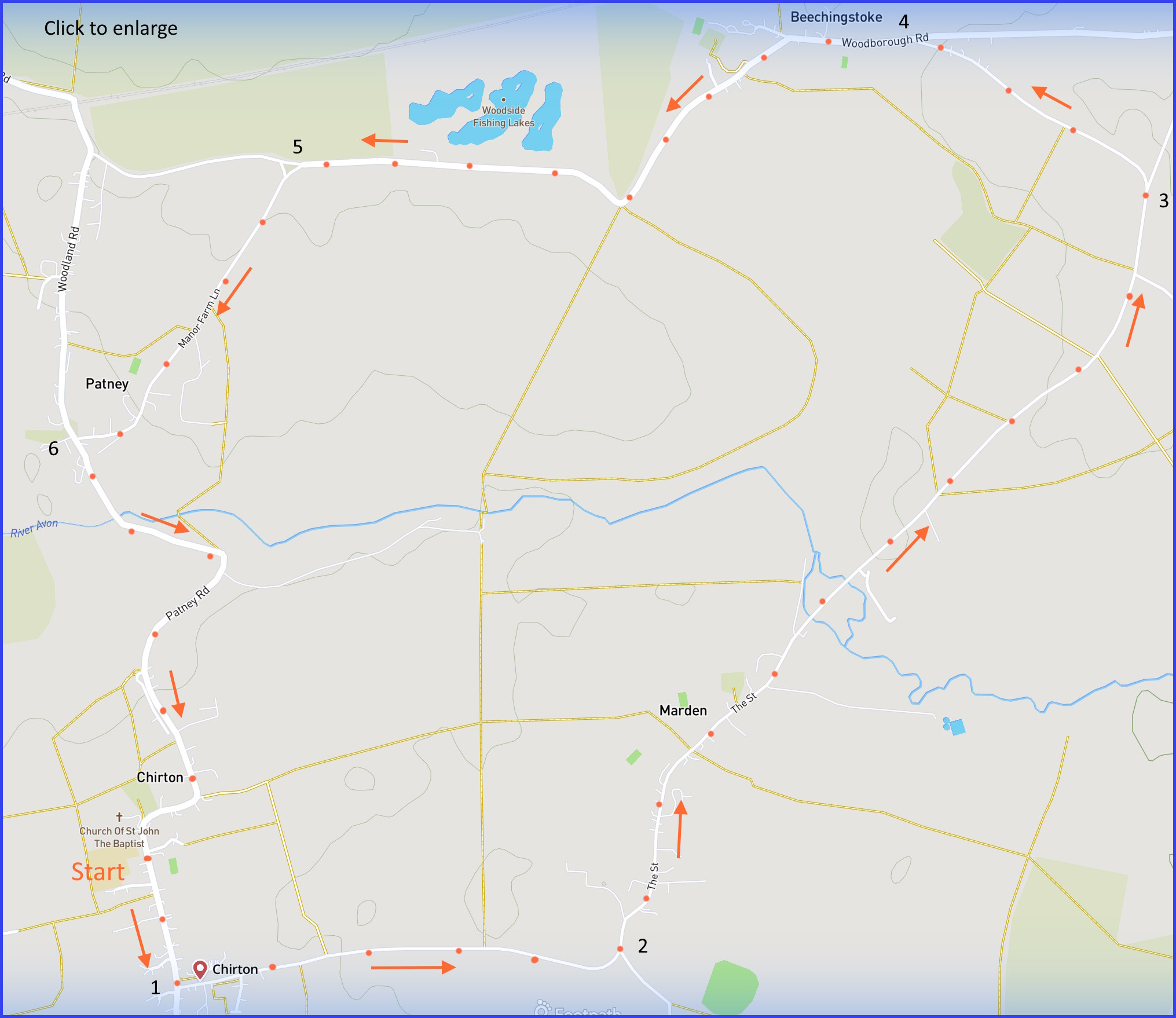
(Routes suggested from each map point + metres to next point)
Start: Park near telephone box library on The Street. Walk south towards ‘Small Street’ junction. 320m
1: At signpost to Marden, take left and walk to junction labelled ‘the Millstream’. 1km
2: At this sign, stay on road as it veers left and northwards to Marden. Cross river, walk to left fork 2km
3: At the fork (“unsuitable for…” sign) take that fork left and walk to Woodborough Road junction. 600m
4: Take left at this junction. Walk through Beechenstoke, past lakes, to left Y-junction. 1.5km
5: At junction, take left fork down Manor Farm Lane to Patney village junction. 780m
6: Turn left and follow road back to Start, crossing the River Avon on route. 1.3km
The pictures below are in the order things were seen on this walk. Clicking on any one will enlarge it (and the slideshow)
![[A]](https://wiltshirewalks.com/wp-content/uploads/2023/01/chirton_01.jpg)
![[B]](https://wiltshirewalks.com/wp-content/uploads/2023/01/chirton_02.jpg)
![[C]](https://wiltshirewalks.com/wp-content/uploads/2023/01/chirton_03.jpg)
![[D]](https://wiltshirewalks.com/wp-content/uploads/2023/01/chirton_04.jpg)
![[E]](https://wiltshirewalks.com/wp-content/uploads/2023/01/chirton_05.jpg)
![[F]](https://wiltshirewalks.com/wp-content/uploads/2023/01/chirton_06.jpg)
![[G]](https://wiltshirewalks.com/wp-content/uploads/2023/01/chirton_07.jpg)
![[H]](https://wiltshirewalks.com/wp-content/uploads/2023/01/chirton_08.jpg)
![[I]](https://wiltshirewalks.com/wp-content/uploads/2023/01/chirton_09.jpg)
The walk
This walk may appeal if you are seeking a no-mud, no-stiles route (although look at the map above for a Chirton to Marden short cut across fields if you prefer). The roads are quite well furnished with verges. The busiest section being the road up to Marden but even that is hardly heavy traffic [B]. Despite crossing four different villages there are no shopping opportunities. The best chance of refreshment is the Millstream pub just beyond Marden. Unusual treat: walking between points 3 and 4 on the map there is a chance to see two Wiltshire white horses at the same time [F] (namely the Alton Barnes and the Roundway Down ones).
Beyond Beechingstoke and to the right of the road are three man-dug lakes where keen fisherfolk come to try for the carp and big perch. In 2012, 5000 trees were planted to enrich the surrounding wildlife and complement the water. Less pastoral and just in the background is the mainline GWR. It borders this area to the north and at one time there was a station for the folk who lived around here (‘Patney and Chirton’, 1900-1966). Never many passengers, its main role was as an arrival and departure point for soldiers heading to Salisbury plain and training – mainly during the WWI period. An extension to this walk – just beyond the marked route – will locate it near the junction at Woodborough Road (top left on the map). Although all that will be found remaining is a footbridge (although its lost its roof). If you climbed it the view would look like this. Famously in the field adjacent to that point, is the site of the Patney Bridge crop circle – once much admired by the crop circling community. The route back to Chirton takes you over the modest River Avon.
The villages
Chirton – once Cherrington – is the largest of the four villages. The main attraction for visitors is St John the Baptist church with its fine Norman font and tiny fifteenth century stained glass window in the porch. Some 12th century interior but much rebuilding in the 14th. As was often the case, the village was originally E-W centred on the church [A] and Manor. But over time living has migrated down towards the Andover main road. Perhaps a more natural centre today would be the primary school (“the little school with a big heart”). Its certainly carved a presence on YouTube. Nearby Conock village was once larger than Chirton, the lane towards it at the church once joined them both to Marden.
Marden is more comfortably centred on its church. Namely, All Saints (“bell ringers needed!”) that is reached by a charming cobbled path [C] with old rectory adjacent. Impressive Norman chancel arch with carved chevrons plus thirteenth century font. But check also the two modern stained glass windows. The Doomsday book says “There is land for 8 ploughs, a mill and 24 acres of meadow, and pasture 3 furlongs in length”. But the village is famed for history far older than the eleventh century. It claims the largest neolithic henge enclosure yet to be discovered in the UK: Marden Henge (aka Hatfield Earthworks) was constructed around 2400 BC. It may have been ceremonial, although some have suggested it was some kind of workshop for Stonehenge builders. Get a perspective on it from this Archaeologist’s video summary. The present walking route cuts right through the middle of its oval shape but, frankly, there is nothing to see [D] – at least for the amateur eye. It’s just a moment for imagination.
Beechingstoke (“there is land for 5 ploughs, a mill, 28 acres of meadow, pasture 1 league long”) is a community on a road. Note the M-shaped thatched roof of the Manor House as you enter the village (and just before a leftwards turn in the road). There is a short lane on your right to the church of St Stephen [G]. Dating back to thirteenth century it has undergone a lot of rebuilding in the time since. Striking is the all-pink nineteenth century former rectory, just next door.
And finally, Patney. Here the thirteenth century church (St. Swithin) has been converted into a private house [I]. The nosey walker will have trouble getting up close, but is bound to wonder what it would be like to live in a converted church. Surely it would require major building (and probably architectural violence) to make much of an upstairs? And double glazing to keep out the cold would be a challenge. On the other hand, there may be a residue of divine protection perhaps. In the end, plenty of people are attracted to this idea of converted church living. And estate agents are quick to help you find opportunities. And then after your impulsive decision is made, consultancies exist to guide your design thinking.
The community
Its striking how all four villages seem to lack much in the way of conventional amenities. Yet their communities seem to be working on it. For instance, there is the binding potential of the internet to help with this. The county’s Neighbourhood Plan makes little mention of internet (and – warning – the signal here is not strong) but something seems to be happening to support use of websites as a community resource. There is a site for Marden with information about local events, talent, a community bus service and where to find a defibrillator. Patney also has a site – although the village hardly seems big enough to generate much ‘news’. These initiatives seem underpinned by the Parish Council but at Chirton, the effort may have been from an individual. And, inevitably perhaps, such worthy efforts can go into decline. So the most recent dated item of news is 2006.
There is one less obvious – and more material – way in which communities can self-support. So each of them have an old red phone box that has been converted into a shared resource. They are a site for exchanging surplus objects, they are libraries and, In Patney, newspapers can be ordered from a Devizes newsagent, who delivers them to the box every morning by 9.30. Moreover, the Marden red phonebox is twinned with one in Thurlestone, South Devon. The first known twinning of its kind. Another Marden triumph – along with the henge of course.