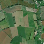
(Routes suggested from each map point + metres to next point)
Start: On exiting the church look for (frequent re-builds) a side path through this built area to get behind it to the clump of trees and left turn left at “1” to lead into open field and westward path away from the church area. 450m
1: Take the left turn and walk forward on path to X-junction. 1.4km
2: Turn right and forward beside several fields to next X-path (or optional detour here). 1Km
3: Turn right. Towards leftward bend (5) in path and then to village. 2Km
4: Pass walled manor house, veering left towards path up to church on right. Then retrace steps. 600m
5: At footpath junction previously past, head south joining river path back to village. 1.3kM
The pictures below are in the order things were seen on this walk. Clicking on any one will enlarge it (and the slideshow)
The walk
There is a parking spot outside the church. This route starts from behind St Nicolas church in Winterbourne and proceeds on a flat, easy track. It is a simple byway walk comprising three sides of a square, each running alongside fields (this area has been pretty treeless for over 300 years). The third corner of the square is the village of Berwick Bassett: a few houses, the Manor (old one and still older one), and a church. The final side of the square does involve field-edge paths but nothing challenging. These run alongside a river – which is the eastern head stream of the Kennett.
The villages
There is little to say about either of these small settlements. Although they both have origins in the early medieval period, with links to Winchester and Glastonbury – hence the monk in ‘Monkton’ (while Bassett is noble family and Winterbourne was formerly a name for the head of the river Kennett). For refreshment needs, there is just a pub in Winterbourne – the New Inn but it is well hidden from this route, lying (with the rest of the village housing) on a lane between the Kennett and the main road.
There are two churches to be seen. The walk starts at St Mary Magdalene: a 13th century chancel and 12th century font but, otherwise, much restored in the nineteenth. However, it has one distinctive and unusual feature. Inside the west end bell tower (three bells) is supported by two massive individual tree trunks (rather than the usual cut timber). Then there is St Nicholas church in Berwick Bassett. It is reached by a charming lane from which it comes suddenly into view as a pleasant surprise [F]. The porch tower has a pyramid hat; the eighteenth century chancel is of an interestingly contrasting red brick.
St Nicholas declares that it is a “redundant church”. Although this rather dispiriting labelling has been lately reviewed by C of E authorities, such that the formerly ‘Redundant Churches Division’ has become the ‘Closed Churches Division’. Churches like this are now looked after by the Churches Conservation Trust – a group that is quite active in selling them off to interested homeseekers. And if that seems tempting, then the closed churches appetite is served by niche consultancies.
Walk detours
Given that these two villages offer the visitor rather limited distraction and given that the walk itself is a little ‘straightforward’, it might be tempting to take a couple of viable detours. For instance, the eastern side of these villages is bounded by the steep Hackpin Hills (or ‘Monkton Down’). If you can find a suitable path (there are some) then you might enjoy being close up with one of Wiltshire’s white horses (the Hackpin one) – even if it looks more like a fox.
More dramatic is the slight detour shown on the above map by a blue dotted route (see entrance point at top right of this picture). That route leads to Windmill Hill, which is the largest of all known (neolithic) causeway enclosures in Britain. This is a type of track above a low wet place – not defensive or a settlement but perhaps a seasonal meeting place where goods might be exchanged. Five bridleways still link to it. It was first occupied around 3800 BC and its excavation is linked to the work at Avebury pioneered by the funds of Alexander Keiller (he of the Marmalade empire). Although there is no track apparent today that links directly to the Avebury site. Archaeologists apparently now treat ‘Windmill Hill’ as a sort of brand name – covering a very distinctive kind of pottery first found in this area.
Not many people visit because its not very accessible (at least from the tourist centre of Avebury). So the path of this route could be regarded as a bit of a bargain. On the other hand, once there it’s hard to be excited unless you are naturally aroused by the thought of standing in the very place that…. etc. Here are some pictures of what to expect at ground level. Evidently the one from the air gives a better sense of the drama. Or…. you could just tell yourself that it’s there – just around the walk corner – and then enjoy this drone video at home.


![[A]](https://wiltshirewalks.com/wp-content/uploads/2023/01/winterbournemonkton_01-150x150.jpg)
![[B]](https://wiltshirewalks.com/wp-content/uploads/2023/01/winterbournemonkton_02-150x150.jpg)
![[C]](https://wiltshirewalks.com/wp-content/uploads/2023/01/winterbournemonkton_03-150x150.jpg)
![[D]](https://wiltshirewalks.com/wp-content/uploads/2023/01/winterbournemonkton_04-150x150.jpg)
![[E]](https://wiltshirewalks.com/wp-content/uploads/2023/01/winterbournemonkton_05-150x150.jpg)
![[F]](https://wiltshirewalks.com/wp-content/uploads/2023/01/winterbournemonkton_06-150x150.jpg)