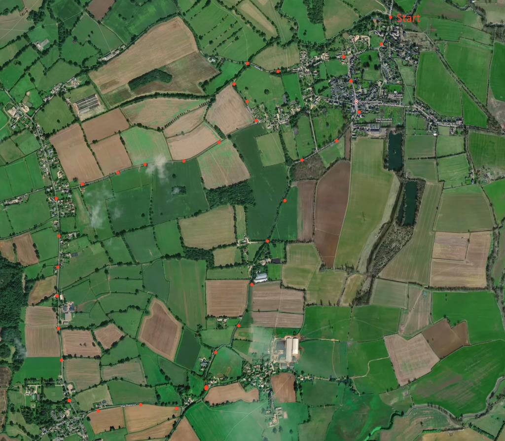
A 4-mile circular walk starting in the village. No fieldwalking, mud, cattle or stiles – mainly light traffic roads, often with grass verges – but sometimes not, especially on last part of route. Enjoy the site of Britain’s first allotments. Click here for an aerial view. Click here for printable PDF download of these notes.
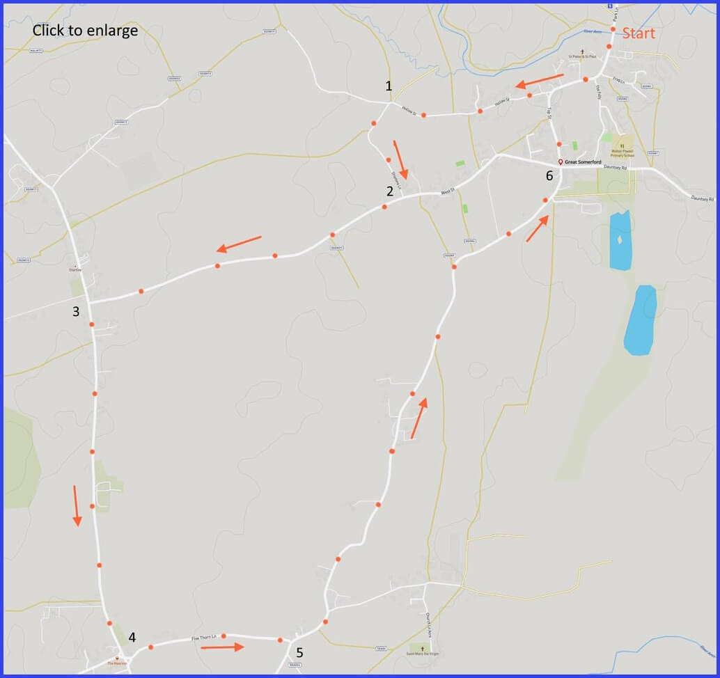
(Routes suggested from each map point + metres to next point)
Start: Walk away from river, staying on Park Lane, veering right onto Hollow Street at the war memorial. Continue until Y-junction. 1km
1: Take left fork here. Follow narrow lane until T-junction. 0.4km
2: Take left. Follow until T-junction. 1.3km
3: Take left direction marked ‘Seagry 1’. Follow until village and 4-way road sign. 1.4km
4: Take the left, signed to ‘Lower Seargry’ on Five Thorn Lane until ‘give way’ junction. 0.6km
5: Turn left. Follow Seagry road towards village and Volunteer Inn. The road route is narrow/bendy – footpath alternative here if anxious: 2.2km
6: Join Top Street and continue back to start. 0.6km
The pictures below are in the order things were seen on this walk. Clicking on any one will enlarge it (and the slideshow)
![[A]](https://wiltshirewalks.com/wp-content/uploads/2023/02/greatsomerford_01.jpeg)
![[B]](https://wiltshirewalks.com/wp-content/uploads/2023/02/greatsomerford_02.jpeg)
![[C]](https://wiltshirewalks.com/wp-content/uploads/2023/02/greatsomerford_03.jpeg)
![[D]](https://wiltshirewalks.com/wp-content/uploads/2023/02/greatsomerford_04.jpeg)
![[E]](https://wiltshirewalks.com/wp-content/uploads/2023/02/greatsomerford_05.jpeg)
![[F]](https://wiltshirewalks.com/wp-content/uploads/2023/02/greatsomerford_06.jpeg)
![[G]](https://wiltshirewalks.com/wp-content/uploads/2023/02/greatsomerford_07.jpeg)
The walk
Suggested parking: by the Avon bridge at SN15 5HZ. Great Somerford is only ‘Great’ relative to the Little Somerford just over the 1799 bridge and down the road. But don’t go in that direction – unless you are interested in the site of former Somerford rail station (closed 1933). Instead, walk away from the Avon, perhaps stretching up to admire the Georgian Brook Farmhouse (just visible in picture [A]).
Shortly, on the right, [B] is the 16th century (but restored) Old Rectory. It lies close to a 40m mound once supposed to be a 12th century motte castle. The Rectory is adjacent to the Church of St Peter and St Paul. The church [C] deserves a visit – in which case, don’t miss the modern and colourful window in the south chancel. It remembers a former vicar who was a missionary in China (hence Christ alongside dragons and asiatic children).
On the left side of the path approaching this church is the oldest surviving house in the village. The Mount House is a timber framed and redbrick house built in 1573, but now equipped with a 19th century front. Its timber-framed outbuilding – nearer the church path – was built in the 17th century. The Mount House was the former home of the Phillips family, whose son (Captain Mark Phillips) married Princess Anne. The pair were apparently united by a shared love of horses and racing – activities still plentiful around this village. Anne was the first of the late Queen’s children to get married and – like all the others – had some children before getting divorced. There is no evidence that this link with royalty gave much benefit to the village – although vigorous local celebrations occurred at the time of the wedding.
On the left at the junction with Frog Lane is the attractive timber-framed 16th century house, Bevis. This name may respect the Bevis stories of author, Richard Jeffries, who lived in a village nearby. Further along, and just before the war memorial, is the 1872 Methodist chapel [D] – although it was originally constructed as a village reading room. From there on, the walk is along flat roads – with some verges but not always. Light traffic but do take care. A detour to St Mary the Virgin at Seagry might seem tempting – but it’s likely to be closed.
The allotments
Just before reaching a possible refreshment break at the Volunteer Inn, some allotments will be visible to the right of the road [G]. These are the oldest continuously-cultivated ‘allotments’ in Britain – their 200th anniversary was celebrated in 2009 by a local edition of Gardner’s Question Time. The origin of these ‘allotments’ makes a touching story.
The very meaning of the word comes from the Great Somerford Inclosure Act (1806). While that was granted thanks to the effort of Stephen Demainbray, who from 1799 until 1854 was Rector of Broad Somerford (the village later changed its name). Demainbray had been chaplain to George III and he used that influence to soften the effect of the 19th century Enclosure Acts, whereby 6 million acres of common land and open fields were ‘enclosed’ at the expense of those small farmers and cottagers who could not prove they had a valid land claim (while to the benefit of existing local landowners).
Demainbray asked the King to spare an area of the land in his parish from the impact of legal Enclosure. This gave some modest protection to the poor of this village. Each cottager being given a 0.5 acre ‘allotment’, often attached to their dwelling. Moreover, a further 8 acres (the ‘Free Fields’) were to be held by the Rector for others of the poor, with holdings allocated on Easter Tuesday according to the size of a family. One of these sites (6 acres) is the one walked past on the present route. Many other Acts followed, inspired by Demainbray’s example, and over the following two decades this idea of allotments spread across Britain. By 1833, seven counties reported having allotments in almost every parish.
Not everyone welcomed this development. The existing landowners did of course, but some farmers felt that this independence of cultivating might be at the expense of their own economic prosperity. However, most of this village must have gratefully welcomed Stephen Demainbray’s initiative – indeed in the church there is a memorial tablet celebrating his generous 95 years.