BA2 9BU 4 mile walk around Newton St Loe, over fields, through a university campus, lakeside paths and back to the charming village. Click map to enlarge. Water is blue, wooded green, contour lines show slopes. Click here for arial view. Click here to download/print PDF. (There is a GPX route option here for phone/tablet download. But only follow this link after watching this GPX help video). Friendly warning: all files relating to walks are published here on good faith but on the understanding that users must be responsible for their own safety and wellbeing.
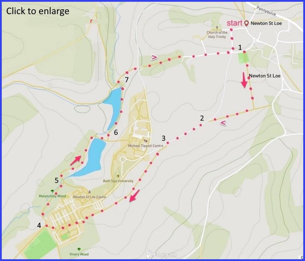
(Routes to take from map points + metres to next point)
0: Walking away from church, turn right at house in picture A. Left at the end of this road until gate into playground on right. 230m
1: Walk across field (350m). Shortly before field boundary turn right and walk (200m) towards join with lane (pic C).
2: Walk towards University gates. 430m
3: May be limited access at gate. If so, use rough footpath in field to side of lane (pic D) to enter campus. Walk to end of campus. 700m
4: Walk round edge to find path down through wood. 450m
5 Drop down towards lake and walk along it. 200m
6: Follow sharp bend to walk along far side of second lake to its end. 350m
7: Up path, cross road and enter second path to return you to village. 700m
The pictures below are in the order things were seen on this walk. Clicking on any one will enlarge it (and the slideshow)
![[A]](https://wiltshirewalks.com/wp-content/uploads/2021/10/01newt.jpg)
![[B]](https://wiltshirewalks.com/wp-content/uploads/2021/10/02newt.jpg)
![[C]](https://wiltshirewalks.com/wp-content/uploads/2021/10/03newt.jpg)
![[D]](https://wiltshirewalks.com/wp-content/uploads/2021/10/04newt.jpg)
![[E]](https://wiltshirewalks.com/wp-content/uploads/2021/10/05newt.jpg)
![[F]](https://wiltshirewalks.com/wp-content/uploads/2021/10/06newt.jpg)
![[G]](https://wiltshirewalks.com/wp-content/uploads/2021/10/07newt.jpg)
![[H]](https://wiltshirewalks.com/wp-content/uploads/2021/10/08newt.jpg)
![[I]](https://wiltshirewalks.com/wp-content/uploads/2021/10/09newt.jpg)
![[J]](https://wiltshirewalks.com/wp-content/uploads/2021/10/10newt.jpg)
The walk
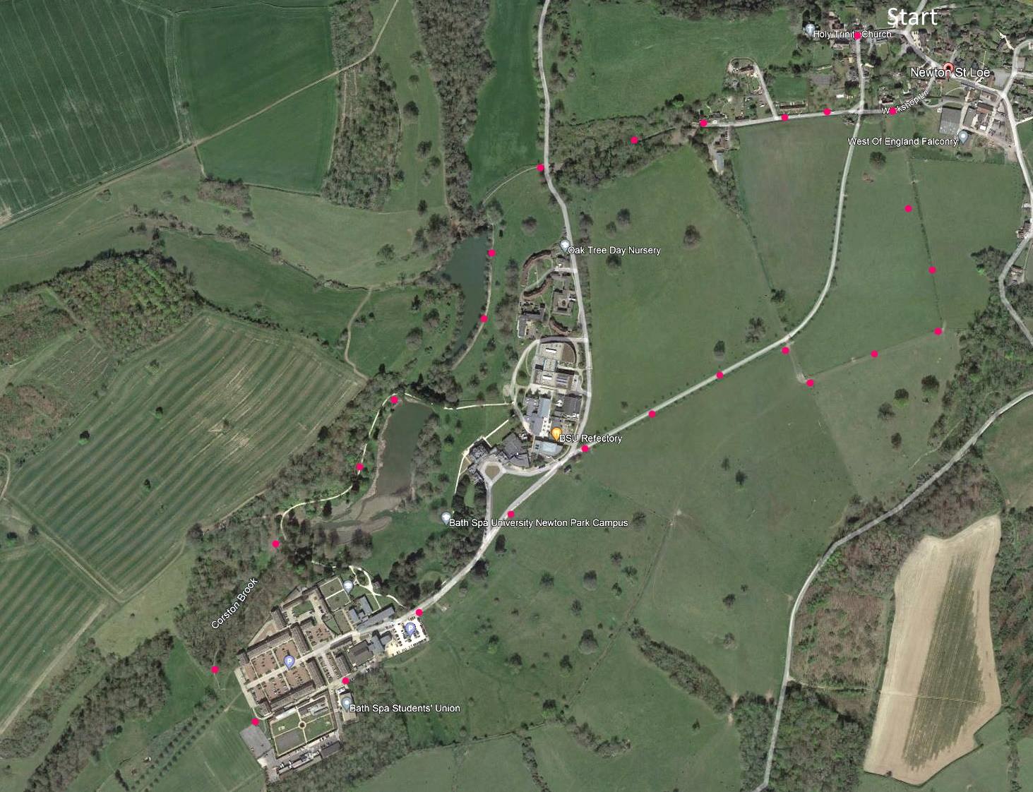
The route circles from Newton St Loe (parking may be a challenge in the village itself). This starting point offers a tranquil, and charming moment before setting off across fields (pic B). The route is fairly flat with a field path joining paved Newton Drive that heads down to the University Campus. Depending on the time of year/day, the official campus entrance at the lane may be an option. If it’s not, then there is a field path that runs parallel to the lane and this does join that campus at a field gate. Walk through the university and finally follow the paths through a traditional English country estate. Might be more occupied during student terms, but it is often postcard picturesque
The village
The Norman village of Newton St Loe contains a large number of listed buildings: well protected and preserved: itself worth a visit, walking or not. But there is no café or pub for refreshment. However, there is just one shop (called ‘The Shop’). However, the look of a village does not always speak its full history. Up until the mid-19th century there were pits here supplying coal to Bath. No sign of those today.
Most of the village (and its surrounding area) was purchased by the Duchy of Cornwall in 1941. In fact the old church Rectory is the headquarters of their ‘Eastern District’ (just how big is this Cornwall Duchy?). Their presence is controversial, following a proposal to build 2000 houses in the area (not yet granted, and possibly abandoned?). The dispute gave rise to much ridiculing of Prince Charles for his evidently suspect environmental credentials.
Notice the ‘Free School’ (established in 1698), which continued to function as the village school until 1972. Also worth visiting is the 14th century Holy Trinity Church. The 15th century west tower has a good set of six bells.
The university
The second half of this walk takes you through the main campus of Bath Spa University. This institution grew out of the old Bath School of Art (partly based at Corsham) and the Bath Teacher Training College – set up after the second war to help with teacher shortages. It was a women’s college offering two-year courses. Following a group of mergers with other small colleges, in 2005, it become Bath’s second university.
Two universities in a small town is surprising. In an age of scaling up academic research groups, an institutional merger might be expected between high profile Bath University and the loose amalgamation that became Bath Spa University. On the other hand the latter’s distinctive and developed niche identity might be attractive, and something to protect. So, Bath Spa does have a high standing in performing arts. For instance, this campus includes the Michael Tippett Centre – the composer had strong connections with the Bath music festival (not quite what it once was). The university botanical gardens offer a potential resting place for the walker – its on the way out at the far end of this campus.
About the Estate
In the latter part of the walk you trail through the original Newton Park Estate – grounds designed by Capability Brown. Odd name? It seems he traded on a promise of: ‘your site is capable of being great (and I am capable of achieving it)’. And so he designs unadorned expanses of grass, water and trees: nature now made the subject, not just the setting. Judge for yourself as you walk on from here (pics E – I).
In the estate is Newton Park, an 18th-century Grade I listed Palladian country house. The Park was designed by Stiff Leadbetter (another odd name – implications uncertain) and built in 1762–5 for Joseph Langton. Langton was distinguished as the man beaten by William Pitt the Elder in the 1757 Bath election. There is a monument to Langton’s father in the Holy Trinity Church – a monument which Pevsner says is “stately, restrained…worthy of Westminster Abbey”.
The grounds were set with artificial lakes and cascades, a wild space very ‘capably’ landscaped perhaps. The house itself is currently home to the administrative staff of the university (who traditionally in this sector always get the most distinguished buildings). This house was once the residence of the Lady Anna Temple-Nugent-Brydges-Chandos-Grenville (1820-79) – who, despite her daunting aristocratic pedigree, was an active campaigner for women’s suffrage, including working for the right that women could become doctors. There is more on the history of the estate here.
You will enjoy the lakeside walk, where there are a number of sitting spots. Anglers may be seen, as its a good spot for fishing but otherwise there should be few people about: its pleasingly tranquil – unless you go during university term time. Which is not the best plan.