SN8 1QT A short walk around Avebury (about 3 miles) through neolithic landscape fields, One significant slope. Likely to be other walkers (click map to enlarge. Click here for arial view) Click here to download/print PDF. (There is a GPX route option here for phone/tablet download. But only follow this link after watching this GPX help video). Friendly warning: all files relating to walks are published here on good faith but on the understanding that users must be responsible for their own safety and wellbeing.
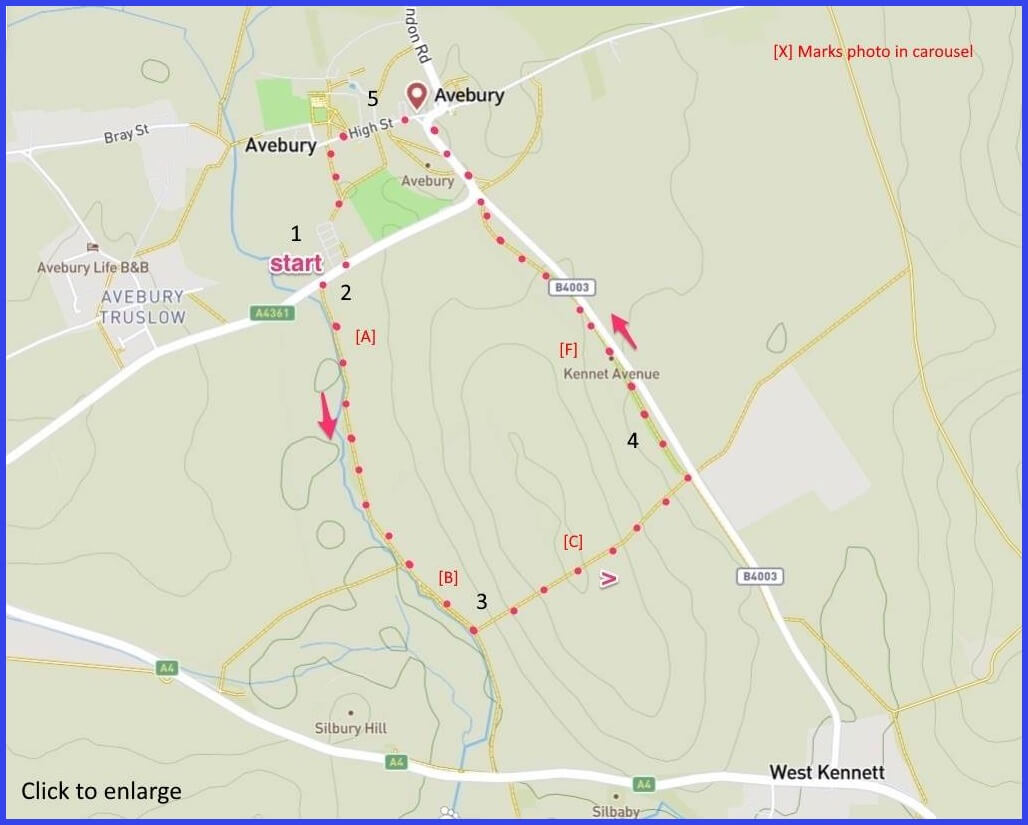
(Routes suggested from each map point + metres to next point)
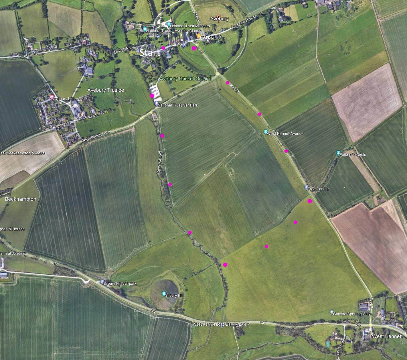
1 Start at National Trust car park. Walk to Beckhampton Road. Right turn. Pick up footpath across this road. 90m
2 Follow path alongside river (picture A). 500m
3 With a view of Silbury Hill on your right (pic B) and 250m from main road, turn left to walk up field incline towards B4003 and a view over the anciet landsape (pic D). 650m
4: Walk along the avenue of stones (pic F) and into the High Street. 1.2km
5:In the village there is some pleasant domestic sights here including the parish church (pic I). There is a marked footpath nearby that takes you back to the car park. 600m
The pictures below are in the order things were seen on this walk. Clicking on any one will enlarge it (and the slideshow)
![[A]](https://wiltshirewalks.com/wp-content/uploads/2021/10/01ave.jpg)
![[B]](https://wiltshirewalks.com/wp-content/uploads/2021/10/02ave.jpg)
![[C]](https://wiltshirewalks.com/wp-content/uploads/2021/10/03ave.jpg)
![[D]](https://wiltshirewalks.com/wp-content/uploads/2021/10/04ave.jpg)
![[E]](https://wiltshirewalks.com/wp-content/uploads/2021/10/05ave.jpg)
![[F]](https://wiltshirewalks.com/wp-content/uploads/2021/10/06ave.jpg)
![[G]](https://wiltshirewalks.com/wp-content/uploads/2021/10/07ave.jpg)
![[H]](https://wiltshirewalks.com/wp-content/uploads/2021/10/08-ave.jpg)
![[I]](https://wiltshirewalks.com/wp-content/uploads/2021/10/09ave.jpg)
The walk
Park in the National Trust car park – if you are not a member you must pay. The walk runs first alongside the River Kennet, taking a view of Silbury Hill. Then there is a steep climb required for entering the dramatic avenue of Avebury stones. This leads to the village where there are a few buildings to admire, a parish church and a haunted pub. There are likely to be other visitors on and around this walk – although they may be concentrated in the village.
The stones
The 100-stone sarsen circle (and internal smaller circles) within a henge (ditch with high bank) was here before the village (which is 18th century): in fact the circle is the earliest known Neolithic settlement in the country, and the largest in Europe. Perhaps sadly, it’s also the only one harbouring a small village within its circumference and roads that quarter its circle. One of its problems has been the legacy of mediaeval Christians knocking it about as ‘pagan’ – even plundering the stones when building village houses. Village development has been purposely thinned out since the 1930s, This is partly thanks to wealthy enthusiast Alexander Kieller (heir to the Dundee marmalade fortune) buying up the village and surrounds for excavation in 1934, taking the Manor House for himself to live in. His passion for the place did help recover it and render it more visible. But the scattering of uneven stones at this site still makes it hard for the inexperienced visitor to get a sense of geometry and scale without consulting diagrams.
It’s likely that you will get your main neolithic impact when walking down the parallel line of stones (map point 4; pic G). That passage comprises the ‘West Kennet Avenue‘ which seems to have linked the Circle to the nearby Sanctuary site on Overton Hill. There may have been other linking avenues of this kind to similarly sites similarly related in their purposes. Your other point of potential visiting impact is Kieller’s coach house and stables, converted by him (1938) to a museum of the site (ironically incorporating plundered stones). Plus the adjacent 17th century timber, thatched Great Barn which has been recently renovated to house a display of Wiltshire rural life.
The hill
You will also walk past chalk-and-clay Silbury Hill (2400 BC?) – it’s construction calculated to have needed 10 years, at least if built by 700 men: their labour making it the largest of its kind in Europe. A truncated cone with a flat top (from which you can see the four main neolithic sites in this area). Commentators are fond of saying this work was contemporaneous with (or preceding) the Pyramids (and Silbury is about the same size as some of them). Yet it’s remains unclear what the Hill was for. It doesn’t seem to have been used for burial. The ‘walking artist‘ Richard Long has made use of his walk up this Hill to create a successful gallery piece. Point 4 on the map is where you will get a compelling and memorable view (pics D & E). This drone video may also help you place it.
Don’t forget the village
That just leaves the village. It has a good share of 18th century and later domestic buildings (pic H). Avebury Manor (16th / 17th century) is on the site of a dissolved Benedictine priory and now owned by National Trust. There is the 17th century Red Lion pub for refreshment – the only pub known to be within a neolithic stone circle. More often overlooked but outside the pub is the round stone of an old cider pressing mill. The Red Lion also has its own ghost story. Well several actually. One arises from it’s former status as a nineteenth century coaching inn (a farmhouse before that) – a ghostly carriage clatters through its yard occasionally. Then there is the story of poor Florrie. She was put away by her husband who, returning from the Civil War, found her with a lover (killed him also). Florrie’s body was thrown down a well – the one that is now glassed over as a table in the bar.
And finally there is the parish church of St James (pic I) some parts of which date back to 1000AD, the south doorway being strikingly Norman. Also find a rare rood screen and loft at the East end – surviving the removal of such catholic paraphernalia in the Henry VIII period.
If you seek a video account of the place for a bit more detail and context, try this long version (30′) or for something more snappy and a bit less romantic, try this short version (3′).